
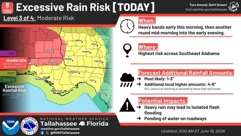
Heavy showers and thunderstorms fueled by the first named storm of the 2026 Hurricane Season could move across the Tallahassee area Friday, along with a slight chance of excessive rain and a marginal risk of severe weather, according to the National Weather Service.
Forecasters say the setup includes deep tropical moisture left behind by the remnants of Tropical Depression Arthur, combined with a stalled boundary that will act as a focus for repeated storm development.

A flood watch remains in effect through Friday night across much of the western Florida Panhandle, from Pensacola up to Panama City and Marianna, as forecasters warn that repeated bands of rain could lead to dangerous conditions.
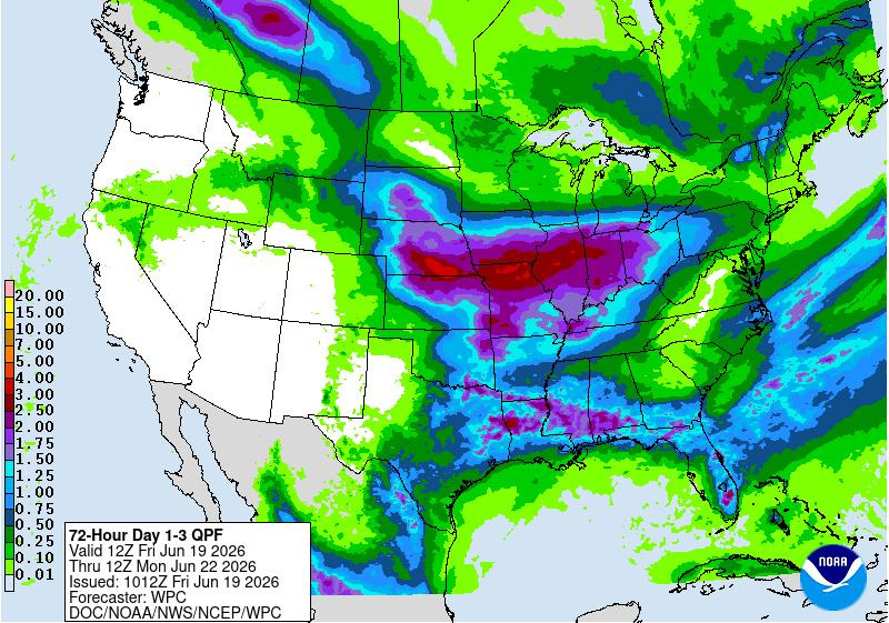
The National Weather Service in Tallahassee said widespread rainfall totals of 3 to 7 inches are possible there, with isolated areas potentially seeing 8 to 12 inches where storms repeatedly track over the same locations.
“High rain rates and training bands will increase the chance of dangerous to life-threatening flash flooding,” forecasters said in a Friday morning forecast discussion.
Closer to home, the Tallahassee area has a 90% chance of rain and could see up to an inch of rain. Scattered showers and thunderstorms could then occur through the weekend.
Tallahassee in the lower end risk zone
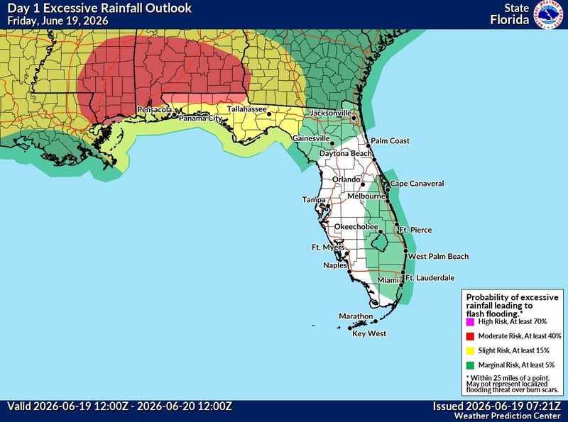
While the highest rainfall totals are expected west of Tallahassee — particularly in southeast Alabama and parts of the western Panhandle — Leon County remains in an area with a slight chance of inundating rainfall.
The Weather Prediction Center has placed much of the region, including Tallahassee, under a Level 2 risk of excessive rainfall, meaning there is a 15% chance of flash flooding within 25 miles of any given point.
That combination could lead to intense rainfall rates in a short period of time, increasing the risk of flooded streets, rising creeks and rapidly changing conditions.
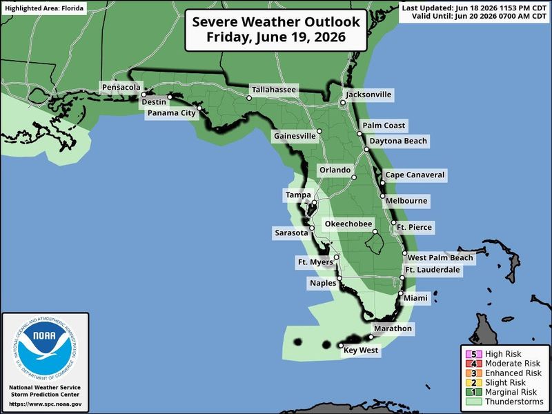
Severe storms also possible
In addition to flooding concerns, Tallahassee and the surrounding region face a Level 1 (marginal) risk of severe weather Friday.
That means isolated storms could produce:
The primary severe threat will be damaging wind gusts, with forecasters noting storms could organize into clusters or short lines as they move through the area.
Looking ahead through the weekend
The unsettled pattern is expected to gradually ease after Friday as a front pushes through the region, though scattered storms could linger into the weekend.
For now, forecasters say Friday will be the most impactful day, with the combination of heavy rain and repeated storms posing the greatest risk.
Here’s the full forecast breakdown for Tallahassee from the National Weather Service.
Portions of this weather report were generated automatically using information from the National Weather Service and a story written and reviewed by an editor.
This article originally appeared on Tallahassee Democrat: Bouts of heavy rain, severe weather possible in Tallahassee
Reporting by Staff reports, Tallahassee Democrat / Tallahassee Democrat
USA TODAY Network via Reuters Connect
By Staff reports, Tallahassee Democrat | USA TODAY Network