A severe thunderstorm warning was issued for parts of Franklin County late morning on Aug. 10 as storms rolled through central Ohio, with forecasters warning the active weather pattern could continue for much of the week.
The National Weather Service issued the warning at 10:43 a.m. for northeastern Franklin County, southeastern Delaware County and northwestern Licking County after radar indicated a severe thunderstorm near Sunbury capable of producing wind gusts up to 60 mph. The warning remains in effect until 11:15 a.m.

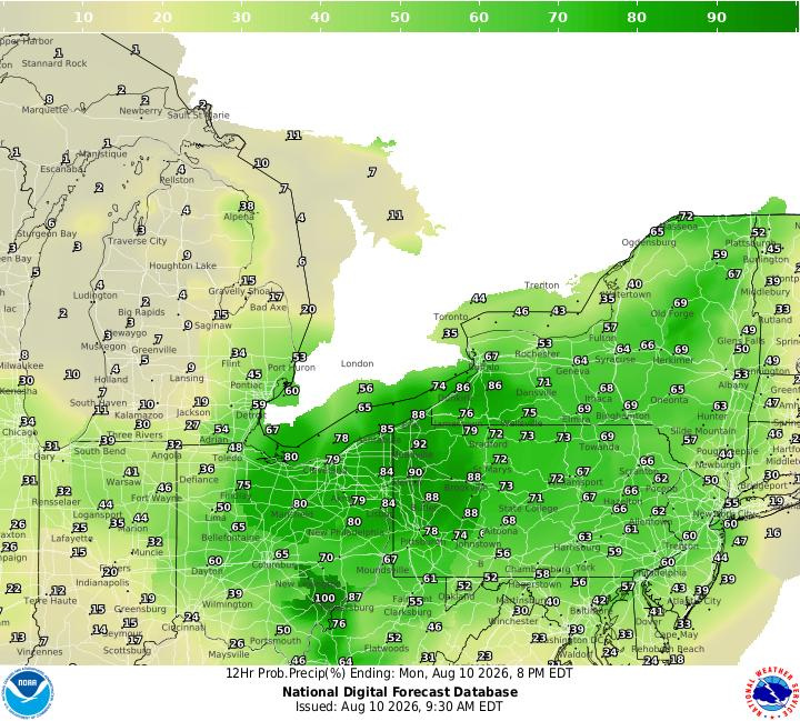
More rounds of showers and thunderstorms are expected in the beginning of this week, as forecasters warning that some storms could produce damaging winds and flash flooding.
The National Weather Service in Wilmington says warm, humid conditions will fuel several rounds of thunderstorms throughout the day and into the night on August 10.
The unsettled pattern isn’t expected to end anytime soon, with additional rounds of rain and storms forecast through at least Aug. 13.
Here’s what to expect.
Columbus weather forecast for Aug. 10
Showers and thunderstorms are likely throughout Aug. 10, especially before 1 p.m., though additional storms are expected to develop later in the day and continue into the evening.
The National Weather Service forecasts a high near 88 degrees with west winds of 8 to 11 mph and gusts up to 21 mph. Rain chances sit at 70%, with between a quarter and a half inch of rainfall possible during the day.
The greatest concerns are damaging wind gusts and flash flooding, according to the National Weather Service’s hazardous weather outlook.
Storm chances continue at night, with a 60% chance of showers and thunderstorms. Additional rainfall between one-half and three-quarters of an inch is possible overnight.
What is the weather forecast for Aug. 11?
The wet weather is expected to continue Aug. 11.
Showers and thunderstorms are forecast throughout much of the day, with a 90% chance of precipitation and a high near 86 degrees.
Rainfall totals between one-half and three-quarters of an inch are possible during the day, followed by another wet night. Forecasters say between 1 and 2 inches of rain could fall overnight in some areas, raising the risk for localized flooding.
When will the rain end in Columbus?
The National Weather Service expects an active weather pattern to continue through at least Aug. 13.
Daily chances for showers and thunderstorms remain in the forecast Aug. 12 and Aug. 13, with storms capable of producing damaging winds and repeated rounds of heavy rainfall.
Conditions gradually improve heading into the weekend.
Aug. 14 still carries a 40% chance of showers before skies become drier in the night. Aug. 15 currently looks to be the week’s best day for outdoor plans, with mostly sunny skies and a high near 83 degrees. A slight chance of showers and thunderstorms returns Aug. 16.
Trending reporter Amani Bayo can be reached at abayo@dispatch.com.
This article originally appeared on The Columbus Dispatch: Columbus weather forecast includes storms, possible flash flooding
Reporting by Amani Bayo, Columbus Dispatch / The Columbus Dispatch
USA TODAY Network via Reuters Connect

By Amani Bayo, Columbus Dispatch | USA TODAY Network