The National Weather Service is predicting a slight chance of more rain Tuesday after torrential rain and flooding washed through the region Monday.
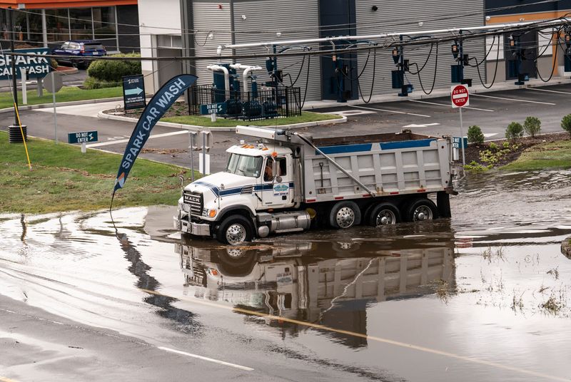
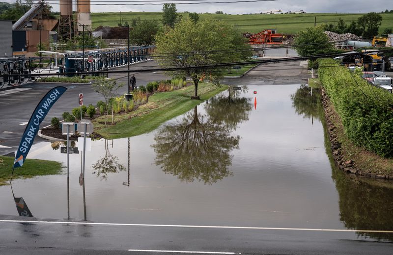
Several isolated thunderstorms swept the New York metro region Monday, July 14, from the mid-afternoon to the late evening. Many areas in Westchester, Rockland and New York City experienced flash flooding and closed roads.

Lower Hudson Valley rainfall totals for July 14
According to the National Weather Service, Rockland County received the most rain out of any area in the Lower Hudson Valley.
Nanuet had numerous road closures between 5 p.m. and 9 p.m. By 1 a.m. Tuesday morning, total rainfall measured 5.03 inches, the highest reading of any municipality in the region.
In comparison, Westchester, Putnam and New York City received as high as 3 inches of rain in some areas, with severe flooding on public transit tracks, major roadways near rivers and streams, and low-lying parking lots.
Rockland County rainfall totals
Westchester County rainfall totals
Putnam County rainfall totals
New York City rainfall totals
Mid-week forecast for Lower Hudson Valley as of July 15
The National Weather Service predicts that rain will continue to show up through Friday, July 18, but more torrential downpours are likely not in the Lower Hudson Valley’s near future.
Tuesday morning commuters can expect to deal with some remaining traffic delays and road closures following the aftermath of the storms Monday. Driving conditions may be worsened by patchy fog before 9 a.m.
Skies Tuesday morning will be cloudy and should gradually clear by the afternoon. A 20% chance of showers and thunderstorms remains throughout the day, but rainfall totals are not predicted to surpass 1 inch.
High temperatures Tuesday will reach up to 87 degrees. Overnight, patchy fog will return after 11 p.m. but skies will remain partly cloudy and temperatures may drop to around 72 degrees.
Wednesday is also expected to bring some morning fog before 9 a.m., but skies should be partly sunny with high temperatures near 89. A heat advisory is likely to be in effect Wednesday afternoon, as heat index values may make temperatures feel like 99 degrees.
Showers and thunderstorms may also be possible Wednesday afternoon, with a 30% chance of rainfall after 2 p.m. By the evening, the chance of rain could increase.
Looking ahead
Thursday may see a 50% chance of showers and thunderstorms until around 8 p.m. However, skies are looking partly sunny with high temperatures near 91 degrees. Overnight, temperatures may drop to around 75 degrees.
Friday may also bring some showers between 2 p.m. and 8 p.m., but the beginning of the day is expected to be mostly sunny with a high of 89 degrees. By the evening, skies will become mostly cloudy with temperatures near 68 degrees.
This article originally appeared on Rockland/Westchester Journal News: Hudson Valley weather: Slight chance of more rain after flooding in Rockland, Westchester
Reporting by Alexandra Rivera, Rockland/Westchester Journal News / Rockland/Westchester Journal News
USA TODAY Network via Reuters Connect