
Drought conditions in Iowa improved for a second consecutive week, though areas of moderate drought expanded in parts of the state.
The U.S. Drought Monitor offers a state-by-state tracking of drought conditions nationwide. New maps and forecasts are released each Thursday. What are the current drought conditions in Iowa?

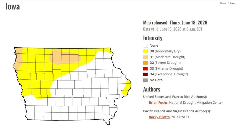
U.S. Drought Monitor map: How much of Iowa is in a drought?
The latest Drought Monitor report, released on Thursday, June 18, showed about 46% of Iowa experiencing some form of drought. This continues the streak of conditions improving week to week in Iowa. The previous report, released on June 11, showed that 63% of the state was experiencing some form of drought.
The most recent report reflects conditions as of 8 a.m. June 16, right as storms were sweeping through Iowa, with parts of eastern Iowa seeing more than 2 inches of rainfall. Light rainfall on June 17 led to areas like Iowa City and Burlington reporting around an inch of rain.
Here is the breakdown of current drought conditions in Iowa:
Even though drought conditions have improved overall in Iowa, the area experiencing moderate drought increased from the week of June 11, particularly in northern Iowa. Much of Cerro Gordo, Hancock and Kossuth counties are under D1 conditions, with nearby Palo Alto, Winnebago, Floyd and Mitchell also in moderate drought.
Pockets of moderate drought also persist along the northwest edge of Iowa in Lyon, Sioux and Plymouth counties. In eastern Iowa, Jackson, Clinton and Scott counties saw their moderate drought status ease week to week.
Most of the U.S. is facing drought conditions
About 73% of the U.S. is experiencing some level of drought, a 2-percentage-point improvement from the prior week. Some of the most intense drought conditions are in the southeast and the mountain west.
Iowa Drought Monitor tracks conditions weekly
The U.S. Drought Monitor offers a state-by-state tracking of drought conditions nationwide. New maps and forecasts are released each Thursday.
The intensity levels range from abnormally dry, or D0, to exceptional drought, or D4.
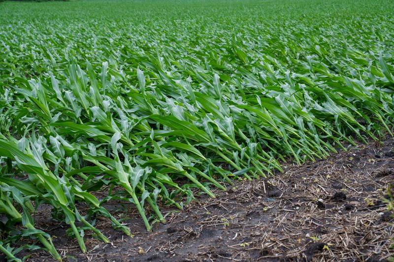
Typically with D0 conditions, corn can show drought stress. Pond levels start to decline under moderate drought conditions and soybeans abort pods, according to the Drought Monitor. The Drought Monitor also has a look-back chart that compares drought conditions from 3 months ago up to 1 year ago.
Cooper Worth is a service/trending reporter for the Des Moines Register. Reach him at cworth@gannett.com or follow him on X @CooperAWorth.
This article originally appeared on Des Moines Register: Rain brings second week of relief in Iowa drought monitor map
Reporting by Cooper Worth, Des Moines Register / Des Moines Register
USA TODAY Network via Reuters Connect
By Cooper Worth, Des Moines Register | USA TODAY Network