
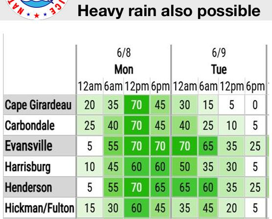
EVANSVILLE – Large parts of the Tri-State are under a flood watch Monday as multiple, “repetitive storms” are expected to sweep through the area.
The heaviest chance of rain in Evansville extends from noon to 6 p.m., according to a bulletin from the National Weather Service. The city will have a 70% chance of rain during that span. And the precipitation will extend well into Tuesday morning.

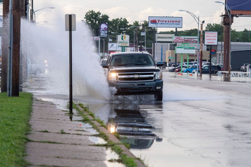
That could spark flash flooding in the city and beyond, forecasters said Monday. Heavy rain had already started by 9:30 a.m.
Severe weather chances and a hot humid week
The NWS also placed most of the Tri-State under a “marginal” risk for severe weather: the lowest rung on the service’s five-point scale.
“Gusty winds or a brief tornado” are the main concern, the bulletin states.
The storms will move out Tuesday, leaving behind warm temperatures and thick air. Between Tuesday and Thursday, heat indexes could hover between 100 and 103.
Evansville weather radar
This article originally appeared on Evansville Courier & Press: ‘Repetitive storms’ and flooding possible in Evansville Monday
Reporting by Jon Webb, Evansville Courier & Press / Evansville Courier & Press
USA TODAY Network via Reuters Connect
By Jon Webb, Evansville Courier & Press | USA TODAY Network