This story will be updated.
The National Weather Service and the National Oceanic and Atmospheric Administration are reporting rising river levels across Indiana, and the City of Anderson’s White River has shattered the previous record.

On Aug. 13, Gov. Mike Braun declared a statewide disaster emergency after continuous storms dumped inches of rain and brought tornado-like winds throughout the state. He mobilized the Indiana National Guard and other state agencies to respond to flooding, damage and power outages. Relentless rain has contributed to floods and higher water levels around the state’s rivers.
These were the water levels as of 11:30 a.m.
These were the water levels as of 9:30 a.m.
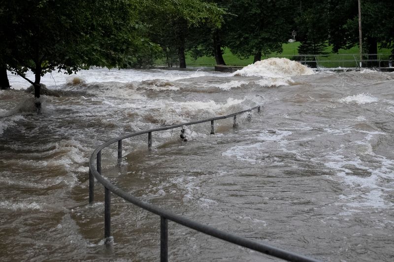
The White River reached record levels in Anderson, measuring 24.75 feet in the early hours of Aug. 14. The previous record was 23.6 feet. Current White River water levels in Anderson are about six times higher than Aug. 10, before the severe storms began.
Gages at Fall Creek measured just over 10 feet around 6:45 a.m. near Fortville. At Millersville, the gauges measured more than 11.5 feet of water. Last week, the creek was about 2 feet deep.
Water levels for the White River in Indianapolis shot up to almost 12 feet at 6:45 a.m. Aug. 14, gages show. In Noblesville, the White River reached almost 18 feet at 5 a.m. On Aug. 13, the White River peaked at 18.5 feet in Muncie – more than three times as high as it was just days earlier, though the levels dropped down to about 12 feet by the morning of Aug. 14.
On Aug. 12, gages measured levels at about 3 to 5 feet along the river from Delaware County to Indianapolis. Since then, the river has grown about three to six times deeper, depending on the area.
The Wabash River in Wabash measured just under 8.5 feet on Aug. 14, dropping from about 11.5 feet on Aug. 12. Near the Theodore Dreiser Memorial Bridge in Terre Haute, the Wabash River measured at 12.5 feet, and forecasters expect it to reach almost 20 feet by Aug. 17. In Delphi, the Wabash River reached 14.25 feet on Aug. 13.
Water levels in the Tippecanoe River also spiked to about 8 feet deep at the State Highway 18 Bridge. Gages reported similar levels for the river near Delphi. At the Oakdale Dam, waters reached more than 12 feet, gages from the morning of Aug. 14 reported.
The Big Blue River in Carthage, a small rural town about 40 miles east of Indianapolis, shot up exponentially. It measured at less than 1 foot on Aug. 12, but rose to 12 feet deep late on Aug. 13.
Aubrey Wright is a breaking news reporter for the Indy Star. She can be reached at amwright@indystar.com.
Get breaking news alerts on your phone →download the IndyStar app. Start your morning with the top Indy news delivered to your inbox.
This article originally appeared on Indianapolis Star: How high are Indiana’s rivers after storms and flooding?
Reporting by Aubrey Wright, Indianapolis Star / Indianapolis Star
USA TODAY Network via Reuters Connect
By Aubrey Wright, Indianapolis Star | USA TODAY Network