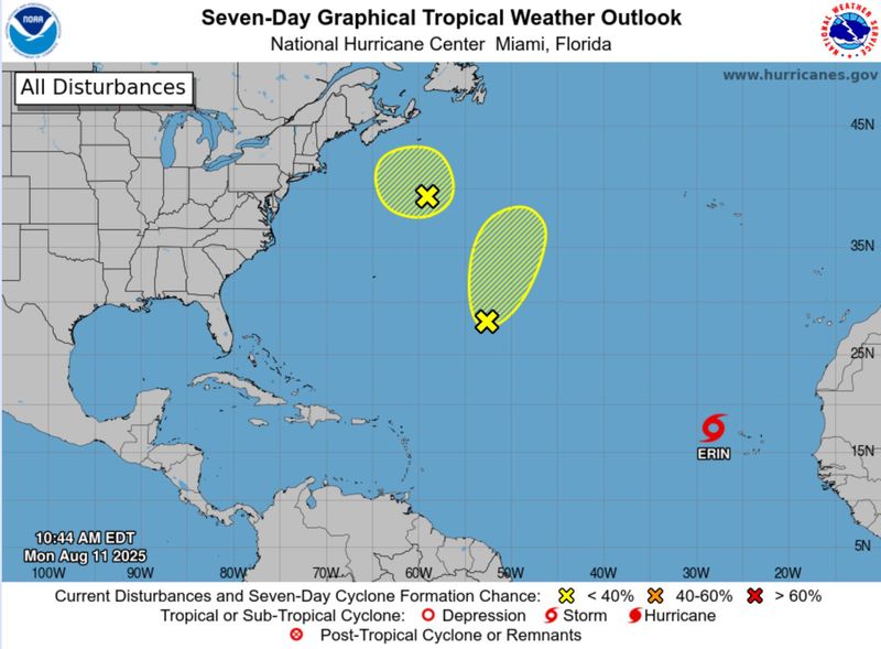
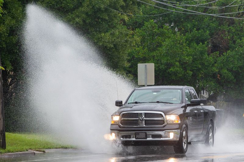
Northwest Florida is expected to receive heavy rainfall over the next few days with a possibility of localized flash flooding, according to the National Weather Service in Mobile, Alabama.
A weak surface trough in the northeastern Gulf near the Florida Panhandle is associated with a broad area of disorganized showers and thunderstorms, according to the Weather Service.

The system has a near zero chance of strenghening into a stronger storm.
There is a 70% chance of thunderstorms today with new rainfall amounts between a quarter and half of an inch possible.
Showers and thunderstorms are likely tonight, mainly after 4 a.m. The Weather Service has forecast a 60%. chance of precipitation and another quarter to half inch of rain possible.
The chance of precipitation rirses to 80% Tuesday, mainly before 4 p.m., and new rainfall amounts between half and three quarters of an inch are possible.
The chance of rain dips to about 30% Tueday night, but rises again Wednesday afternoon.
There is a 70% chance of precipitation Wednesday, then a 20% chance of showers and thunderstorms Wednesday night before 1 a.m.
Thursday brings a 50% chance of showers and thunderstorms, though skies should clear by Thursday night.
However, the rainfall will only relent for a short while. There is a 40% chance of rain each day on Friday, Saturday and Sunday.
The temperature will also start to heat up heading into the weekend. After several days of highs in the mid to upper 80s this week, the high will hit 90 degrees on Thursday and hover around 92 or 93 degrees through Sunday.
This article originally appeared on Pensacola News Journal: Heavy rainfall and possible flash flooding forecast for Pensacola region
Reporting by Pensacola News Journal / Pensacola News Journal
USA TODAY Network via Reuters Connect