
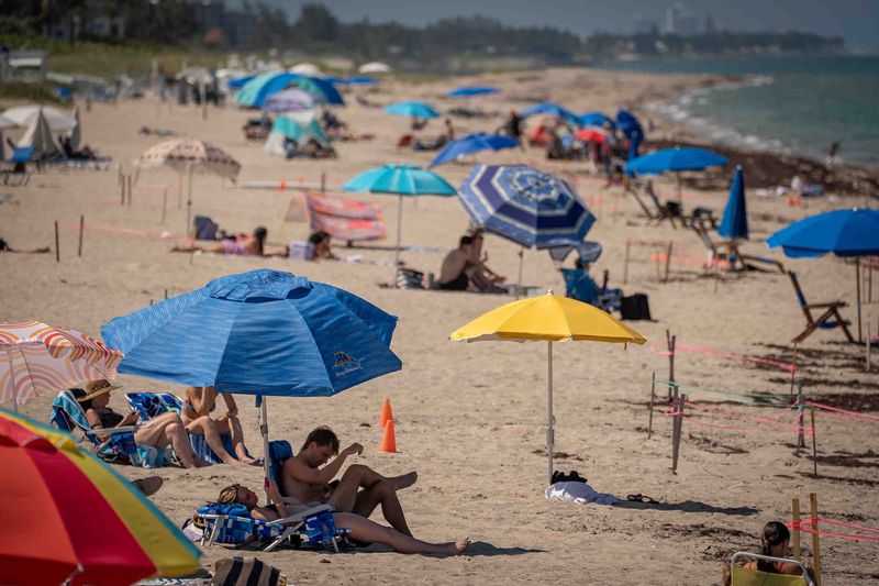
Florida will mostly dodge a dangerous heat dome forecast to overwhelm parts of the country next week, but it won’t escape an abnormal summer boil with record-challenging temperatures and lottery-like rain chances.
Through the weekend, the air will seethe into the low to upper 90s throughout the state, with heat index or “feels like” temps topping 105 in many areas and potential heat records set in the Tampa Bay area and Gainesville.

“The core of the heat dome will stay north of Florida and Florida will just be in its typical ‘it’s hot regardless pattern’ with thunderstorms every afternoon,” said AccuWeather meteorologist Peyton Simmers. “The ongoing drought makes it easier for the sun to heat up the ground so it’s just been generally warm.”
While Florida may miss the heat dome, which is a slow-moving clockwise swirl of high pressure, it is included in the Weather Prediction Center’s “hazardous heat map” through July 2. The center also notes an area of heavy rain forecast for the Big Bend region on June 29, which is one of the hardest hit areas of the state for drought.
Drought lessened statewide as of the latest U.S. Drought Monitor report released Thursday.
Still, nearly 80% of Florida remains in some form of drought more than a month into the rainy season and with a typically drier July ahead.
Why July in Florida is typically drier than other rainy season months
July is when the biggest plumes of Saharan dust reach across the Atlantic, desiccating the upper atmosphere, killing clouds and increasing sunshine.
In the 16-county region south of Orlando that is overseen by the South Florida Water Management District, the 30-year average rain amount for July is 7.2 inches. That’s compared to 8.6 inches in June, 8 inches in August and 7.3 inches in September.
Sammy Hadi, a meteorologist with the National Weather Service in Miami, said areas of metro Miami-Dade County had increased drought conditions per Thursday’s report from the U.S. Drought Monitor.
Rain totals at the Miami International Airport are down 7.2 inches for the month of June as of June 26. Fort Lauderdale has a deficit of 7.1 inches and West Palm Beach is down more than 3 inches, according to official National Weather Service gauges.
“Here, locally, our pattern is dictated by summertime breezes and thunderstorms and the timing of the thunderstorms,” Hadi said. “Delayed thunderstorms allow us to heat up quickly because there is so much moisture in the air and ample sunshine.”
Hadi said he doesn’t expect a major change in pattern through July 4.
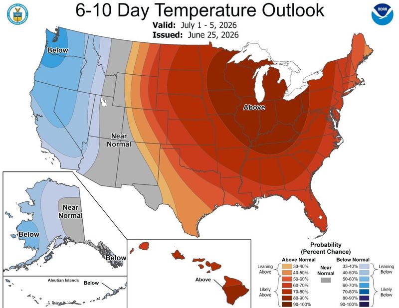
That’s supported by the Climate Prediction Center forecast, which shows a 60% to 70% chance of above normal temperatures for all of Florida through July 5.
Meteorologists at the NWS office in Jacksonville said the heat dome may take a swipe at areas of North Florida by providing what’s called a “back door cold front” where northerly winds lead to onshore breezes.
Their forecast says high temperatures will “cool” to the low 90s along the I-95 corridor and mid 90s near I-75 on Tuesday. Coastal areas could dip into the 80s.
“We are really looking forward to that,” said Jacksonville-based NWS meteorologist Ben Nelson. “Then we go back into a hotter southwesterly flow that prevents the sea breeze from moving too far inland.”
Hurricane experts looking at the Gulf and off the east coast of Florida
The tropics have been on pause since Arthur’s short-lived but soggy slog through the Gulf Coast, but hurricane experts are looking at the low possibility that something may develop next week along a stalled front either in the northeast Gulf or off the coast of Central Florida in the Atlantic.
The National Hurricane Center had no areas marked for potential development as of Friday.
Still, senior meteorologist Noah Bergren with FOX 35 Orlando, pointed to Google’s artificial intelligence hurricane model called Deep Mind, which was giving low chances of something tropical spinning up.
Deep Mind was used operationally for the first time during the 2025 hurricane season and met or bested the National Hurricane Center’s official forecast for both track and intensity.
Bergren said Deep Mind was the first to hit on the potential for Arthur to develop.
“Quite frankly, I’ll be honest — my first reaction looking at this model forecast was to scratch the side of my head and go ‘what the heck?’” he said on social media. “Definitely an interesting scenario we don’t see to terribly often.”
Hurricane expert Michael Lowry with WPLG Channel 10 in Miami also noted that while the odds are low for anything to develop, waters off the east coast of Florida are at record to near-record warmth for this time of year and that wind shear is lower than in the main runway between Africa and the Caribbean.
“If anything were to develop, it would be closer to land and likely steered back in the direction of the U.S. for the July 4th holiday weekend,” Lowry said in his Eye on the Tropics column. “For now, it’s not anything to worry about, but something we’ll want to check back on in the coming days and into next week.”
Kimberly Miller is a journalist for the USA TODAY NETWORK FLORIDA. She covers weather, the environment and critters as the Embracing Florida reporter. If you have news tips, please send them to kmiller@pbpost.com. You can get all of Florida’s best content directly in your inbox each weekday by signing up for the free newsletter, Florida TODAY, at palmbeachpost.com/newsletters.
This article originally appeared on Palm Beach Post: Florida faces ‘hazardous heat’ into July 4 week with potential records
Reporting by Kimberly Miller, USA TODAY NETWORK – Florida / Palm Beach Post
USA TODAY Network via Reuters Connect
By Kimberly Miller, USA TODAY NETWORK – Florida | USA TODAY Network