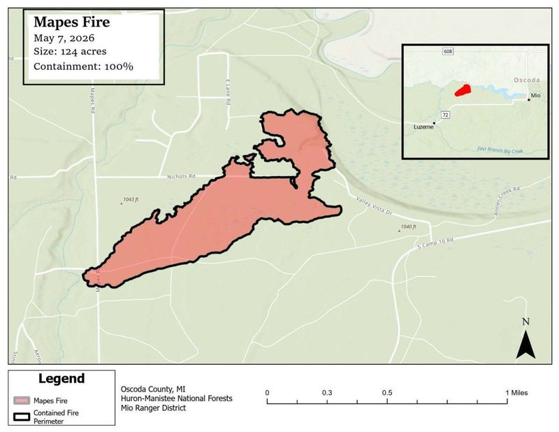
An Oscoda County wildfire has been fully contained, the U.S. Forest Service announced on May 7.
The 124-acre Mapes fire, which began Monday afternoon, May 4, around 5 miles west of Mio, is now 100% contained, meaning the 34-personed crew has successfully secured a cold perimeter around the fire to prevent it from spreading, the U.S. Forest Service Huron-Manistee National Forests team said in a May 7 release.

“Today (May 7), crews will continue the effort to identify remaining sources of heat and strengthen containment lines. Repair of firelines, to return them to a more natural condition, has been initiated,” the U.S. Forest Service Huron-Manistee team said.
The cause of the wildfire is believed to be a power line that arced due to Monday’s strong winds, May 4, according to U.S. Forest Service Huron-Manistee National Forest District Ranger Greyling Brandt, however the cause remains under investigation according to the May 7 update.
The blaze destroyed a cabin and a residence, Brandt said.
Michigan residents are urged to remain wildfire-aware as dry, windy and relatively warm weather is forecast for the rest of the week — of which are the ideal conditions for a wildfire.
Here’s more on the Mapes fire and how to stay wildfire-aware in Michigan.
Is the Mapes fire in Michigan fully contained?
Yes. Officials at the U.S. Forest Service Huron-Manistee announced the Mapes fire in Oscoda County was at 100% containment on May 7.
What is the current wildfire danger in Michigan?
As of May 7, the Mesowest Great Lakes Fire and Fuels map shows much of Michigan is under high or very high fire risk. Only a few areas in the state’s southwest, and eastern Upper Peninsula were at the lower medium ris.
The map provides updated information about Michigan wildfire risk statewide each day.
How can I find out if there is a wildfire nearby?
There are several online resources available amid Michigan’s wildfire season, including:
Does Michigan typically see wildfires this time of year?
Yes. Wildfire season for Michigan occurs mainly in the spring from April-June, according to the Western Fire Chiefs Association. Michigan firefighters respond to 10,000-12,000 wildfires each year of varying sizes.
In May 2012, a lightning strike caused fire to spread and burn near Newberry in the central U.P., known as the Duck Lake Fire. The blaze burned 22,000 acres of land and 136 structures were lost — one of the largest wildfires in the state in the 2000s.
What causes wildfires in Michigan?
A combination of low humidity, heat and windy conditions create high risk for fire to easily catch.
Under such conditions, “the main cause (47%) of wildfires in Michigan is burning yard debris, such as grass clippings, leaves, and trash,” according to Michigan Prepares.
What does wildfire fuel mean?
Wildfire fuel is a broad term to describe the vegetation, sticks, trees, grass, soils and more that allows a wildfire to keep burning.
The main fuels for the Mapes fire in Oscoda County are mixed conifer, brush, and short grass, according to the Incident Information System.
Contact Sarah Moore @ smoore@lsj.com
This article originally appeared on Lansing State Journal: Mio-area wildfire 100% contained after 4 days, officials say
Reporting by Sarah Moore, USA TODAY NETWORK / Lansing State Journal
USA TODAY Network via Reuters Connect