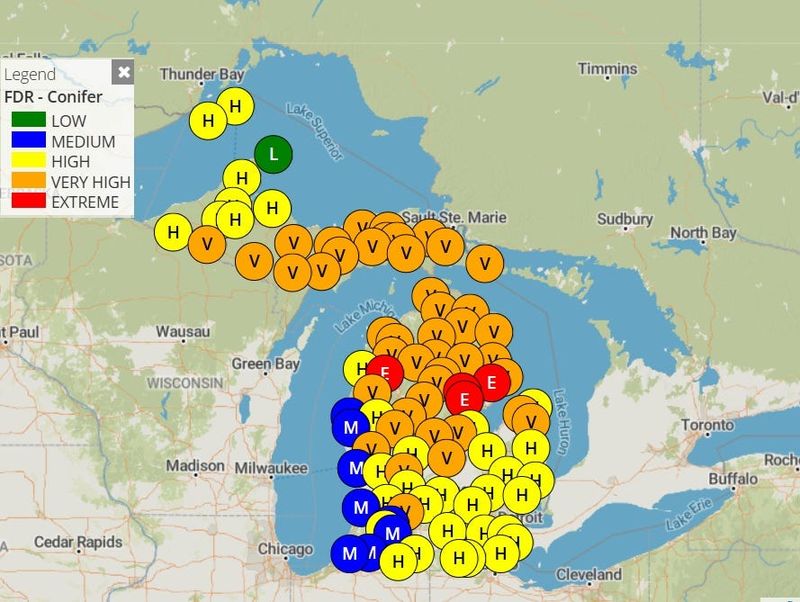
An unusually dry week-plus is shaping up across the Great Lakes region, leading the Michigan Department of Natural Resources to urge those enjoying the outdoors to take caution against sparking a wildfire.

“We do not expect significant rainfall over the next 10 days, and that greatly increases the risk for wildfires,” said DNR fire prevention specialist Paul Rogers. “Low moisture levels in conifer needles and dry pine fuels mean fires can start easily and spread quickly under the right conditions.”
Due to elevated fire conditions, the DNR will not issue permits for burning yard debris in the northern Lower Peninsula and Upper Peninsula at this time. Residents in southern Michigan should check with their local fire department or municipality before conducting any outdoor burning.
The Great Lakes region is in an “Omega block” − a low-pressure system in eastern Canada and New England, and another low in the interior western U.S., with a ridge of high pressure in the middle, where the Great Lakes sit. The name comes from the upper air flow patterns that ensue from such a phenomenon, which looks something like the Greek letter Omega: ω.
“As we are sitting underneath this ridge of high pressure, the storm systems are all directed basically in every direction around us, and it keeps us dry and sunny for the most part,” said Trent Frey, a meteorologist with the National Weather Service in White Lake.
The Weather Service’s forecast “basically has zero rain” forecasted over the next seven days, for anywhere in Michigan, Frey said. And it’s not uncommon for Omega block patterns to last a week or even longer, he said.
“There is not much forcing to get them to move in any direction, and so we’re kind of just left in between,” he said. “They can be stagnant for a while.”
Temperatures were predicted above normal in Metro Detroit on Friday, May 29, reaching the mid-80s, with more typical springtime highs in the 70s through the weekend and into next week. A warm-up is forecasted for the middle of next week, with highs getting back into the 80s, Frey said.
“Certainly with as much sunshine as we are getting, everything could lean toward drier conditions that the DNR would start to be concerned about,” he said.
DNR safety tips to prevent wildfires include:
Additional wildfire prevention and fire safety information is available at michigan.gov/firemanagement.
Contact Keith Matheny: kmatheny@freepress.com.
This article originally appeared on Detroit Free Press: Michigan faces rising wildfire risk with no rain in forecast for several days
Reporting by Keith Matheny, Detroit Free Press / Detroit Free Press
USA TODAY Network via Reuters Connect