CANTON TWP. — Township officials are studying stormwater patterns, clearing creeks and preparing to inspect hundreds of neighborhood detention ponds as efforts to reduce flooding continue in the community.
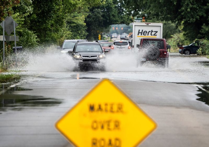
An August 2023 storm that dropped 4 to 5 inches of rain in just a few hours flooded at least 225 homes, shut down major roads and overwhelmed the community’s stormwater system, the township’s 2025 master plan notes.

“We’re taking the flooding in Canton very seriously, but there’s really no silver bullet,” Supervisor Anne Marie Graham-Hudak said. “This is a multi-pronged issue that we have to work together to fix.”
Neighborhood pond inspections coming
Municipal Services Director Dave Norwood said the township has been working with Wayne County and developers to address maintenance issues along waterways such as Fowler Creek, including removing log jams and managing beaver dams that can block water flow.
Beaver activity, he noted, has become an issue as water quality in the Rouge River watershed improves.
“The water has gotten so good that they’re coming back,” he said, noting crews recently found a beaver weighing more than 70 pounds, as well as a lodge “that two grown men could live in.”
Norwood said the township is also launching a program to inspect more than 300 stormwater detention ponds across the community in the months ahead.
Staff, he said, will use a geographic information system-based app to document conditions at each pond and generate reports that will be shared with the homeowners associations responsible for maintaining them.
“The reports will say, ‘This is your problem’ or ‘Your pond is working just fine,’” Norwood said, noting the inspections could identify issues like sediment buildup, blocked outlets or erosion that may affect how the ponds handle stormwater.
Planning for future development
Development standards are also a consideration in the flooding strategy.
Canton Community Planning Manager Patrick Sloan said most new developments must meet stormwater standards set by Wayne County because local detention ponds and drainage systems typically flow into county drains.
However, he noted, township staff often work with developers on ways to improve those systems beyond the minimum requirements.
“We’ve prioritized more in the plan review of developments, especially in areas where there has been flooding or issues with stormwater management,” Sloan said. “We have worked with developers to try to design their systems to exceed standards in light of that.”
Sloan said that approach is being applied to a proposed development by Pulte Homes in partnership with Del Webb west of Denton Road near Geddes Road, where about 471 detached senior housing units are planned.
At a February 2025 planning commission meeting, several residents voiced concerns that the development would contribute to more issues in the flood-prone area.
Because the property includes Fellows Creek and sits near areas that have experienced flooding, the developer has been working with engineers to design a stormwater system that exceeds minimum standards, Sloan said.
The site also contains wetlands and a regional detention basin shared by nearby developments, prompting revisions to the plan, including road layout changes and a reduction in the number of homes.
The project is still in the special land use and preliminary site plan stage.
‘Likely storms will get more intense’
Township officials are also looking at rainfall trends as they plan for future flooding.
At a March 3 study session of the Canton Township Board of Trustees, Katherine Labuhn, a senior hydraulic engineer with the U.S. Army Corps of Engineers, presented the results of a stormwater modeling study looking at how water moves through parts of Canton during heavy rainstorms.
Labuhn opened her presentation with a 25-year look at hourly rainfall recorded at Willow Run Airport, showing a noticeable increase in extreme downpours in recent years.
The question, she said, is whether those storms represent a new normal and how to plan infrastructure when most design standards rely on historic rainfall records.
“I think the only broad consensus anyone can agree on is, it’s likely that storms will get more intense,” she said.
The study focused on two areas: the Fellows and Willow creek corridors and the township’s southwest corner where residents have reported repeated flooding.
In the creek corridors, Labuhn said the model suggested flooding in some locations may be tied to issues such as sediment buildup or road crossings that restrict water flow, while in other areas water simply pools on low sections of the road during intense storms.
The study also looked at flooding near Geddes and Barr roads, including the Grand View and Grand Lakes Estates neighborhoods.
The model compared land conditions from before the Grand View Estates development with current conditions and found Geddes Road may not have flooded during the storms under the earlier terrain, Labuhn said.
The modeling also showed the recent raising of Barr Road had little impact on flooding along Geddes. Other potential approaches, including berms and barriers to redirect water, reduced flooding in parts of the neighborhood in the model but did not eliminate flooding along Geddes Road, the study showed.
Labuhn noted the study was intended to help identify possible solutions but does not provide engineering design. Additional data and future modeling could help refine the analysis, she said.
Contact reporter Laura Colvin: lcolvin@hometownlife.com
This article originally appeared on Hometownlife.com: Canton tackles flooding problem with pond inspections, creek clearing
Reporting by Laura Colvin, Hometownlife.com / Hometownlife.com
USA TODAY Network via Reuters Connect