As Michigan residents venture to beaches and undock their boats for another season, it is important to check local conditions on the Great Lakes by using online wave and rip current maps.
On Tuesday, May 26, a high swim risk was issued for northern Lake Michigan — particularly in Schoolcraft County near Lakeview Park and Seul Choix Point — for 3-4 foot waves and rip currents that could sweep swimmers away from the shore and tire them out.

“Stay out of the water and away from dangerous areas and break walls,” Marquette National Weather Service said on social media on May 26.
Such beach hazards on the Great Lakes — including small craft advisories and gale warnings — will be updated daily through the summer, and officials maintain online maps that show a comprehensive list of risks for boaters and swimmers.
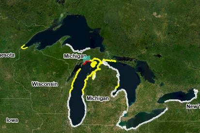
The NWS beach hazard map provides details on wave heights, wind speeds, temperatures and more.
Here are some useful definitions and how to use the NWS beach hazard map:
How can I check beach conditions in Michigan?
The beach hazard map updated by the NWS shows current and predicted conditions for all Great Lakes. The map forecasts wave height, winds, max temperature, UV index and more information on currents, water quality and incident statistics.
Here’s how to read the map:
In addition, residents may check wave height predictions by viewing the NWS Great Lakes Portal, which updates wave heights, wind gusts and air temperature forecasts.
What does a gale warning mean?
A gale warning is issued when winds or frequent gusts, in the range of 34 knots (39 mph) to 47 knots (54 mph) are either predicted or occurring, and not directly associated with a tropical cyclone, the NWS glossary explains.
What does a small craft advisory mean?
A small craft advisory is issued when there are expected sustained winds of 22 knots (around 25 mph) or frequent gusts of 25 knots (around 28 mph) or greater, or combined seas of 10 feet or more.
Small crafts include owners of small to medium sized motor and sail boats, affecting fisherman, para-sailors, windsurfers and canoe paddlers.
How is a rip current dangerous for swimmers?
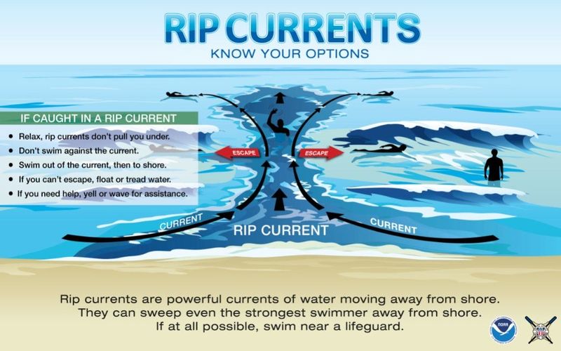
Along the Great Lakes, rip currents are strong, narrow channels of fast-moving water — moving at speeds up to 8 feet per second, according to the National Ocean Service. The relentless current pulls swimmers away from shore.
“If caught in a rip current, don’t fight it. Swim parallel to the shore and swim back to land at an angle,” said the program.
Contact Sarah Moore @ smoore@lsj.com
This article originally appeared on Lansing State Journal: High swim risk day on northern Lake Michigan. How to track conditions
Reporting by Sarah Moore, USA TODAY NETWORK / Lansing State Journal
USA TODAY Network via Reuters Connect