Severe weather is expected to sweep west to east across Michigan Monday afternoon, May 18, officials say, bringing damaging winds, hail, localized flash floods, and even isolated tornadoes.
Michigan’s Lower Peninsula has the highest risk to see severe weather that is forecast to start in the late morning or early afternoon hours on Monday, May 18, and linger into the evening. Thunderstorms are expected to develop again Tuesday afternoon, May 19.

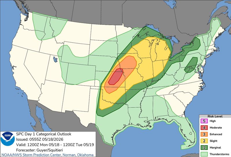
On Monday, isolated tornadoes, 1-inch hail or larger, wind gusts from 40-60 mph and localized floods are the main threats, the National Weather Service in Detroit said.
“A Slight Risk again on Tuesday all of southeast Michigan. Potential exists for thunderstorms to develop during the afternoon and evening capable of producing damaging wind gusts, large hail, locally heavy rain, and/or isolated tornado,” the NWS said.
Residents are urged to review their severe weather emergency plans and to have multiple ways of receiving weather alerts in the day and night.
“Scattered severe storms will be possible across northern Michigan today,” the Gaylord NWS office said on X on may 18. “The most likely time for thunderstorms will be between noon and 7 PM. Any strong storms will be capable of producing damaging winds, hail, and frequent lightning. Tornado potential is low at this time.”
On Monday, May 18, the L.P. is forecast to see highs in the mid- to upper 80s, and the Upper Peninsula is expected to see highs mainly in the 60s-70s.
Here’s the live Michigan radar and the state’s current weather warnings.
Is it going to storm in Michigan today? See current Doppler radar
Current weather alerts in Michigan
Contact Sarah Moore @ smoore@lsj.com
This article originally appeared on Lansing State Journal: Severe weather heading toward Michigan. See current radar, warnings
Reporting by Sarah Moore, USA TODAY NETWORK / Lansing State Journal
USA TODAY Network via Reuters Connect