Most of Michigan is set to continue its calm weather a little longer, but southern areas could see showers and thunderstorms on Wednesday, April 22, the National Weather Service said.
“Chance of showers and thunderstorms 4pm to 8 pm south of I 94 (on April 22). Cooler near Lake Huron. Dry Thursday (April 23) and warm. Showers and thunderstorm chances increase late Friday (April 24) afternoon and Friday night,” Detroit National Weather Service said on April 22.

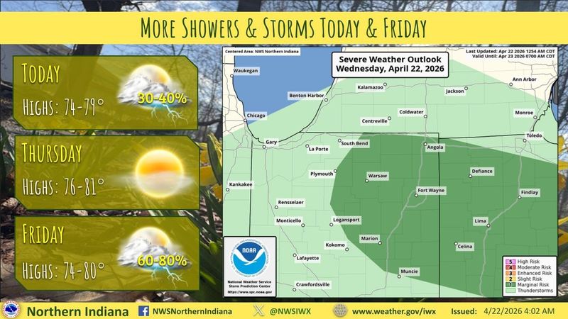
The NWS office for Northern Indiana said there is a thunderstorm risk for southwest Michigan, and most of Indiana and Ohio.
“More storms are expected this afternoon and evening,” the NWS said. “A few strong storms with gusty winds are possible.”
The southern Lower Peninsula is expected to see highs range in the 60s to 70s through Thursday, April 23. The northern Lower Peninsula and the Upper Peninsula will reach the 50s to 60s.
Michigan Doppler weather radar
Where are weather warnings in Michigan right now?
To view the details of a warning, watch or advisory in Michigan click on any shaded region shown on the map.
The bright green lines indicate flood warnings.
Lansing State Journal reporter Sarah Moore contributed.
This article originally appeared on Detroit Free Press: Slight risk of storms April 22 for southern Michigan. See radar
Reporting by Jalen Williams, Detroit Free Press / Detroit Free Press
USA TODAY Network via Reuters Connect