(Story updated to reflect that county burn ban will lift on Wednesday)
This week’s drenching rains won’t likely do much to ease Florida’s drought, especially in groundwater and larger lakes, federal climate officials warn.

Even with several inches of rain predicted through Thursday, much of the heavy downpours will run off into the Indian River Lagoon and countless stormwater ponds — as designed. So drought won’t ease until Central Florida sees several consecutive weeks of rain.
Most likely rainfall amounts this week will range from 1-3 inches inland through Thursday, according to the National Weather Service in Melbourne, with upward of 2-4 inches along the coast.
Expect localized flooding, especially along coast
A Flood Watch was in effect Tuesday along the coast, where the highest amounts, 2-4 inches, are expected through Thursday, with the highest flood risk along the coast. A low chance (10-20%) of 6-plus inches of rain also exists from Daytona Beach to Palm Bay.
“These high-end values, while expected to occur on a more isolated basis, may overcome the drought-stricken soil to cause flooding,” the weater service said. “This is especially the case in urban and poorly drained communities.”
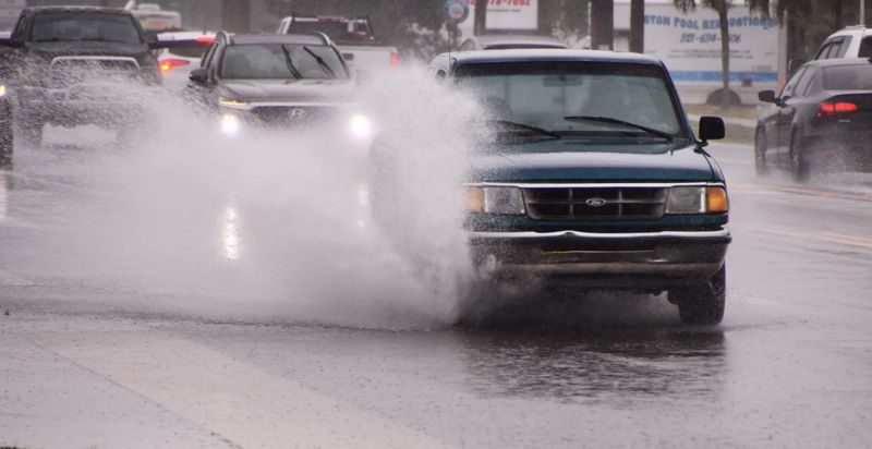
The weather service warned residents and visitors to never drive through flooded roads: “The risk for nocturnally-enhanced rain makes flooding especially dangerous!”
In late October, record rains caused severe flooding that swamped cars and homes in North Brevard.
Brevard burn ban lifts, for now
Brevard’s burn ban kicks in as the Keetch-Byram Drought Index — a key measure of fire risk — tops 500 (out of a scale of 800). Under a county ordinance approved in 2017, the burn ban automatically goes into effect when the index averages 500 or higher. On Monday, the index averaged 541 in Brevard, ranging from 371 to 621.
That means no open burning (to include campfires, bonfires, trash-burning and other similar open incineration) when the ban remains in effect, according to county ordinance.
But by Tuesday afternoon, the index had dipped to an average of 435, thus lifting the ban, for now. Some areas of the county still were as high as 568.
Florida still suffers worst drought in 25 years
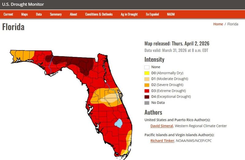
The U.S. Drought Monitor notes that longer‑term deficits across Florida remain significant, even after short bursts of rain. It usually takes weeks of consistent, near‑normal rainfall to improve on official maps drought classifications.
Brevard already is experiencing “severe” drought, with the county’s southern tip and surrounding counties even drier, according to the U.S. Drought Monitor.
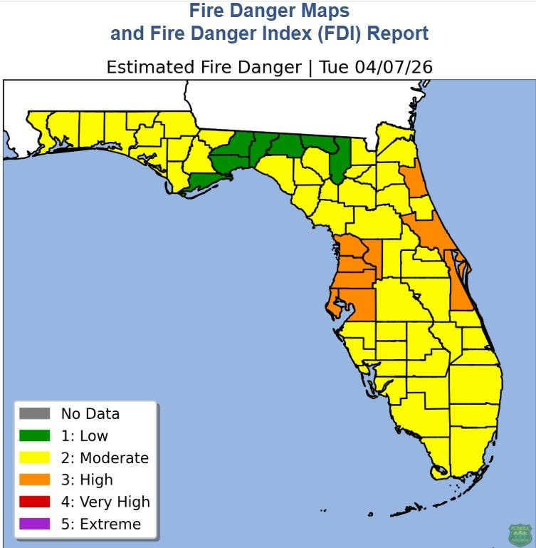
Despite recent rains, wildfire risk in Brevard also remains high, according to the Florida Forestry Service.
Another index, the Wildland Fire Danger Index, estimates the potential for a fire to start and require suppression action on any given day. On Tuesday, it remained “high” in Brevard and several other counties.
Drought, fire risk hinge on El Niño
Severe drought has been closing in on Brevard this year, as a volatile transition from La Niña to El Niño threatens to make fire risk even worse.
Federal forecasters warn El Niño rains won’t likely arrive in time to douse the fire risk in April and May as “dry” lightning hits trees and brush deadened and dried by February’s record cold snap, federal forecasters say.
This week’s downpours come during one of the most dangerous times for wildfires: the transition period from La Niña to El Niño, or to the neutral phase in between the two climate cycles, as the current weak La Niña quickly loses its grip on global weather.
What is El Niño
El Niño is a pattern of warmer than usual water — by 0.5 degrees Celsius — in the Pacific Ocean that influences air and moisture movement around the globe. It pushes the jet stream farther south, over Central and South Florida. That’s good during summer and fall hurricane season because it creates shearing westerly winds that tear apart possible tropical cyclones before they form.
La Niña is the opposite pattern of cooler water in the Pacific.
There’s chance of an especially strong El Niño, which could result in global heat records.
El Niño can lead to a slightly drier-than-normal late summer or early fall for Central Florida, though this is less certain than the winter signal, which brings frequent low-pressure systems, favorable for storms.
In 2024, one of the strongest El Niños on record, forged a stormy winter in Florida.
The severe Florida wildfires in 1998 were driven by the reverse of this year’s pattern. The year began with plentiful winter rain during an El Niño, causing overgrowth. But then, in early April, El Niño shifted abruptly to La Niña, which brought hot, dry temperatures to Florida, turning that abundant undergrowth to tinder for wildfires.
This year, La Niña continued through February, but federal forecasters say there’s a 62% chance of El Niño emerging between June and August and last through year’s end.
And while there is high degree of uncertainty at this point, some European models are more aggressive in predicting a potential “super El Niño” later this year. But those are model outliers rather than the official consensus.
A March heat wave already sent temperatures to summertime levels in some parts of the country. A recently released report by the World Meteorological Organization said that climate is now “more out of balance than at any time in observed history” and and anticipates unprecedented heat into next year.
Waymer covers environment and government. Contact him at (321) 261-5903 or jwaymer@floridatoday.com. Follow him on X at @JWayEnviro.
This article originally appeared on Florida Today: Florida’s drought won’t ease despite recent heavy rains
Reporting by Jim Waymer, Florida Today / Florida Today
USA TODAY Network via Reuters Connect