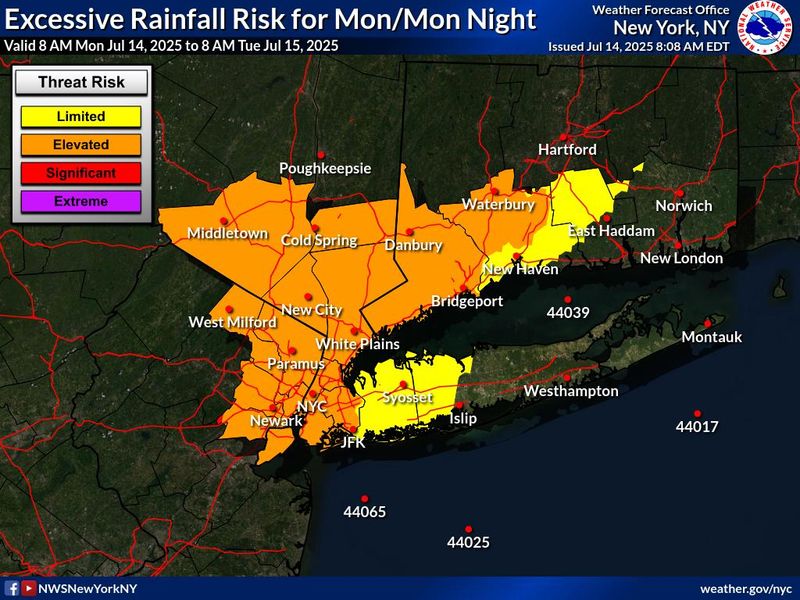
Southern Westchester is under a flood watch starting 2 p.m. Monday, July 14, according to an alert issued by the National Weather Service.
According to the alert, a forecast of scattered showers and thunderstorms, with potential for heavy rains, Monday afternoon and evening could result in rainfall rates of 2-plus inches per hour.

“A widespread 1/2 to 1 1/2 inches of rainfall is likely with localized rainfall totals of up to 3 inches possible,” the NWS alert says. “Much of this could fall in only 3 to 4 hours, causing isolated to scattered instances of flash flooding.”
Flooding in urban and poor drainage areas could be possible due to excessive runoff. “Small rivers, creeks, streams and other low-lying and flood-prone locations” could also flood.
Residents should “monitor later forecasts and be alert for possible Flood Warnings,” the NWS said. “Those living in areas prone to flooding should be prepared to take action should flooding develop.”
This article originally appeared on Rockland/Westchester Journal News: Southern Westchester under flood watch Monday, July 14. See the forecast from NWS
Reporting by Ashley Catherine Fontones, Rockland/Westchester Journal News / Rockland/Westchester Journal News
USA TODAY Network via Reuters Connect