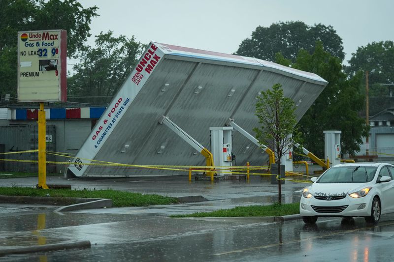
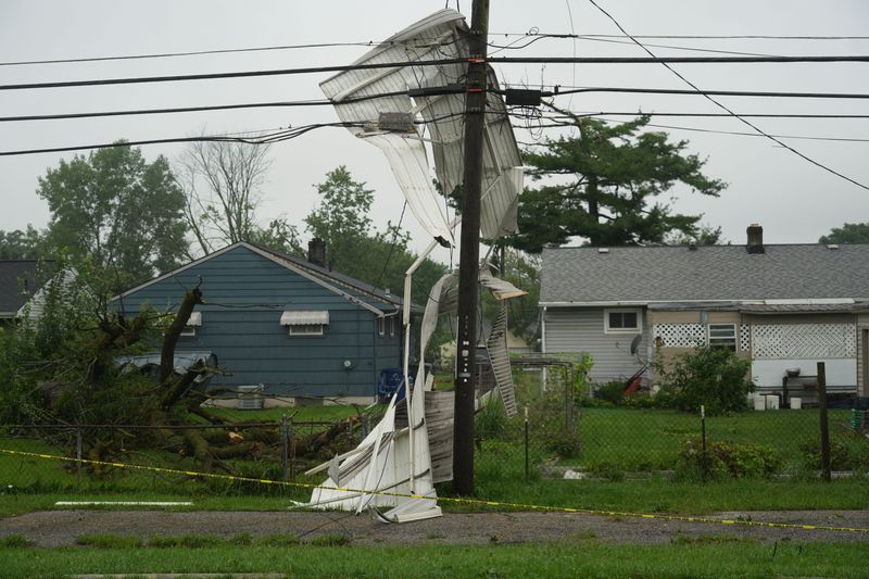
Severe thunderstorms toppled trees, downed powerlines and overturned a vehicle on Interstate 71 Aug. 11, leading many to wonder why no tornado sirens sounded.
The main reason: the National Weather Service did not issue a tornado warning in Columbus during the storm.

The weather service issues tornado warnings when an observer reports seeing one or when radar indicates signs of a rotating column of wind. Franklin County Emergency Management and Homeland Security activates outdoor warning sirens when the weather service issues a tornado warning.
So why no warning? Because the weather service did not see any strong signs of a tornado on radar during the storm, despite reports of significant localized damage in certain parts of Columbus. NWS Meteorologist Kristen Cassady said if there was a tornado, it may have been too difficult to catch on the radar due to the size and intensity of the storm.
“What we saw [was] just a line of storms with intense winds, 60, 70, 80 plus mile per hour winds,” Cassady said. “Sometimes it can be difficult to determine within that broad area of significant, severe wind where these little rotations may develop.”
Cassady said the area saw widespread damage, and much of the damage was most likely due to straight line winds, not suspected tornadoes.
“At the end of the day, we saw pretty widespread damage across central Ohio, and most of that damage was not associated with a potential circulation,” Cassady said. “Most of it was what we call straight line wind damage.”
Under certain conditions, radar scans for signs of tornadoes every few minutes, and sometimes it’s possible for scans to miss a short-lived tornado. But Cassady said the weather service was performing scans faster than usual during the Aug. 11 storms.
“Typically, when we are in situations like yesterday, we put our radar into a faster scanning mode so that with will scan and get us a new image every two to three minutes as opposed to like every five to six minutes,” Cassady said. “That helps us especially when you’re dealing with these fast-moving storms.”
The weather service will determine in the coming days whether a tornado did indeed touch down in Columbus.
The weather service is waiting for calmer weather before it sends surveyors to assess the damage. On the morning of Aug. 12, heavy rain and flash flooding were hitting a portion of eastern Indiana that the Wilmington office also covers, so the office was still responding to an ongoing weather event.
Public safety and breaking news reporter Bailey Gallion can be reached at bagallion@dispatch.com.
This article originally appeared on The Columbus Dispatch: Why was there no tornado warning during Aug. 11 storm? NWS explains
Reporting by Bailey Gallion, Columbus Dispatch / The Columbus Dispatch
USA TODAY Network via Reuters Connect
By Bailey Gallion, Columbus Dispatch | USA TODAY Network