If you’ve seen any maps of Cincinnati generated by artificial intelligence lately, you probably don’t want to use them to navigate.
Mount Adams in Northern Kentucky? A bridge to nowhere? And when did Cincinnati get a “Riaghevmorr” neighborhood.

Here are a few:
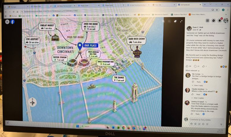
Paycor Stadium and Great American Ballpark seem to have traded spots, and a new river now brackets part of Downtown. Mount Adams has migrated to Kentucky.
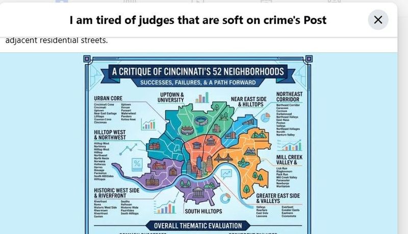
This one, accompanied by a long post, appears to show the city’s 52 neighborhoods, including the famous “Nortmory,” “Walerwhest,” “Darkennood,” and “Everbent.”
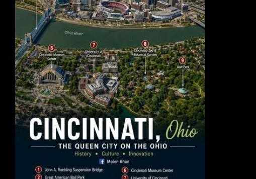
This one put the Museum Center, the Cincinnati Zoo & Botanical Garden and even the University of Cincinnati in Northern Kentucky, while also squeezing Fountain Square between the Heritage Bank Center and the Ohio River.
This one was allegedly provided in a local Airbnb, according to former Cincinnati City Council candidate Evan Holt. Hopefully the guest did not try to turn while on the Roebling Bridge, as the map might suggest.
Why is AI making these absurd maps?
AI famously sometimes hallucinates, confidently making up court decisions that never occurred or making up quotes in stories.
But maps are especially difficult for AI. In July 2026, the U.S. State Department displayed a map at an international conference that misidentified every African country it had labeled. (The State Department said it took “full responsibility” for the confusing map, which had been made using OpenAI, Reuters reported.)
“Generative AI is trained to produce something that looks plausible rather than produce and verify a map that is geographically accurate,” said Andre Curtis-Trudel, an associate professor of philosophy at the University of Cincinnati, founding director of the UC Center for Humanities and Technology and author of several academic papers on AI.
Maps hold a lot of information – names, distances, shapes, neighborhoods, landmarks. On top of that, an accurate map has to show all those in proper relation to each other, he said. In the case of the Cincinnati maps, ‘it ‘knows’ what the landmarks are but doesn’t know where they go,” he said.
“If some elements are even a little bit off, it’s easy to tell,” he said. “Generative AI often struggles to get the details right, which is why it’s so obvious when AI gets them wrong.”
Have you seen a bad AP map of our city? Please email Carl Weiser at cweiser@enquirer.com
This article originally appeared on Cincinnati Enquirer: AI keeps making ludicrous maps of Cincinnati. Here’s why
Reporting by Carl Weiser, Cincinnati Enquirer / Cincinnati Enquirer
USA TODAY Network via Reuters Connect
By Carl Weiser, Cincinnati Enquirer | USA TODAY Network