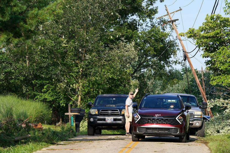
A series of severe storms ravaged Greater Cincinnati and Northern Kentucky on Tuesday afternoon, prompting tornado warnings across the region and producing at least two tornados.
The National Weather Service in Wilmington reported just before 8:45 p.m. July 21 that a tornado struck in Clermont County earlier in the evening. On July 22, the agency confirmed a second tornado in Owen County, Kentucky, about 60 miles south of Cincinnati.

Here’s what to know about the confirmed (and possible) tornadoes and how the weather agency conducts its storm surveys.
Tornado touched down in Clermont County
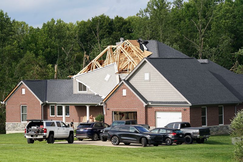
The National Weather Service office in Wilmington confirmed that a tornado touched down in Pierce Township in Clermont County. Officials were assessing storm damage, including a house on Mott Road that had part of its roof torn off.
According to the Clermont County Emergency Management Agency, the tornado was unofficially classified as an EF1 on Wednesday, July 22. At a county commissioners meeting, EMA Director Shawn Riley said no injuries were reported.
Pierce Township sits on the Ohio River about 18 miles upstream from Cincinnati. Part of the village of Amelia sits in its borders.
Tornado warnings were declared around 3 p.m., with reports of debris in the air, according to NWS. Residents were told to take shelter.
A final assessment, including the results of the survey are expected to be completed within the coming days, per NWS.
The weather service is conducting additional damage surveys in Brown County, Ohio, near Hamersville and on the border of Clinton and Fayette counties.
Storm surveys in several Kentucky counties
The National Weather Service said there was video evidence that caught the Owen County tornado. The agency is also conducting a storm survey for areas of Carroll, Gallatin and Grant counties in Kentucky on Wednesday.
Tornado warnings were declared around 3:45 p.m. A final assessment, including the results of the survey are expected to be completed within the coming days, per NWS.
How does the NWS conduct storm surveys?
After severe weather occurs, NWS meteorologists complete the following steps.
For in-person damage surveys, the NWS uses a GIS-based app to log geotagged damage points. Surveyors aim to document the most significant damage and its location, as well as determine the length and width of the damage path.
However, damage assessments can also be conducted remotely by coordinating with local officials and reviewing radar data, photos, videos and high-resolution drone footage.
Why does the NWS conduct damage surveys?
According to the NWS, surveys are conducted to determine whether damage was caused by a tornado or straight-line winds.
If a tornado is confirmed, the agency determines its strength and damage path. If not, it provides an estimated wind speed for straight-line wind damage.
The NWS notes that storm surveys are often conducted when there is significant damage, which may indicate a high-end tornado rating, such as EF4 or EF5.
The Enquirer’s Haadiza Ogwude and Quinlan Bentley contributed to this report.
This article originally appeared on Cincinnati Enquirer: Second confirmed tornado, NWS conducting storm surveys in Kentucky, Ohio
Reporting by Kaycee Sloan and Cameron Knight, Cincinnati Enquirer / Cincinnati Enquirer
USA TODAY Network via Reuters Connect
By Kaycee Sloan and Cameron Knight, Cincinnati Enquirer | USA TODAY Network