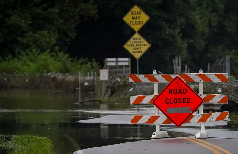
After what’s been a very hot and otherwise mostly dry couple of months, it seems that all of Indiana’s summer rain fell at once: Between Aug. 11 and Aug. 17, parts of central Indiana saw record rainfall and major flooding.
But in the coming days, Indianapolis should see relatively calmer and less muggy weather, according to the National Weather Service.

“It’s going to feel much more like early fall, late summer,” NWS meteorologist Aaron Updike said.
Still, isolated storms could prolong the flooding, which has so far displaced around 1,000 Hoosiers.
There’s a chance for rain beginning on the night of Tuesday, Aug. 18 and lasting through the morning of Thursday, Aug. 20. It will mostly fall south of Indianapolis, Updike said.
The southern part of the state is expected to see higher river levels as water travels downstream. The crest is expected to reach Spencer, about 15 miles northwest of Bloomington, around 2 p.m. Tuesday, Aug. 18.
Indianapolis weather outlook
Monday night: Patchy fog after 1 a.m. Otherwise, partly cloudy, with a low around 62 degrees. North northwest wind 5 to 8 mph becoming calm after midnight.
Tuesday: Areas of fog before 9 a.m. Otherwise, sunny, with a high near 81 degrees. Calm wind becoming west around 5 mph in the afternoon.
Tuesday night: Partly cloudy, with a low around 66 degrees. Light south southwest wind.
Wednesday: A chance of showers and thunderstorms before 8 a.m., then a chance of showers between 8 a.m. and 2 p.m., then showers likely and possibly a thunderstorm after 2 p.m. Mostly cloudy, with a high near 81 degrees. West southwest wind 3 to 6 mph. Chance of precipitation is 60%. New rainfall amounts of less than a tenth of an inch, except higher amounts possible in thunderstorms.
Wednesday night: Showers and thunderstorms likely before 11 p.m., then a chance of showers. Mostly cloudy, with a low around 64 degrees. Light north northeast wind. Chance of precipitation is 60%. New precipitation amounts of less than a tenth of an inch, except higher amounts possible in thunderstorms.
Thursday: A 10% chance of showers before 8 a.m. Mostly sunny, with a high near 79 degrees. North northeast wind 3 to 5 mph.
Thursday night: Partly cloudy, with a low around 62 degrees. North northeast wind around 5 mph becoming calm in the evening.
Friday: Sunny, with a high near 79 degrees. Light northeast wind.
Friday night: A 20% chance of showers after 2 a.m. Mostly clear, with a low around 63 degrees. Light and variable wind.
Saturday: A slight chance of showers, then a chance of showers and thunderstorms after 2 p.m. Mostly sunny, with a high near 79 degrees. Calm wind becoming west 5 to 8 mph in the afternoon. Chance of precipitation is 30%.
Saturday night: A 30% chance of showers and thunderstorms. Mostly clear, with a low around 62 degrees.
Sunday: Sunny, with a high near 76 degrees.
Sunday night: Partly cloudy, with a low around 59 degrees.
Download the IndyStar app to get breaking weather alerts.
Share photos or video of the storm with IndyStar using our online form here.
Ryan Murphy is the communities reporter for IndyStar. She can be reached at rhmurphy@indystar.com.
This article originally appeared on Indianapolis Star: Indianapolis should have calmer days ahead, NWS predicts
Reporting by Ryan Murphy, Indianapolis Star / Indianapolis Star
USA TODAY Network via Reuters Connect
By Ryan Murphy, Indianapolis Star | USA TODAY Network