
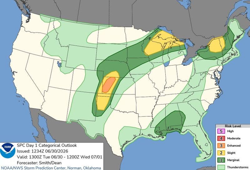
Michigan’s heat wave is forecast to usher in severe storms across the Upper Peninsula and northern Lower Peninsula starting Tuesday, June 30, with strong winds, heavy rain, large hail, and tornadoes possible.
On Tuesday afternoon and evening, June 30, scattered thunderstorms are expected to move through the northern L.P. and the entire U.P. Large hail, downpours, lightning, strong winds and tornadoes could be produced.

“Non-zero chances for tornadoes. Heavy rain will be seen with most storms, which could result in flooding impacts,” the Gaylord National Weather Service.
A flood warning is in place for the Antrim and Charlevoix along the Jordan River because of the chance of additional rain. Several communities in the northern L.P. are recovering from flash floods on Monday, June 29, when up to 4.8 inches of rain fell in some areas.
Statewide, heat indices, also referred to as apparent temperatures — a measurement of combined heat and humidity to show what the air “feels-like” to a person — range from the mid-90s to the low 100s.
An extreme heat warning is place until Thursday night, July 2, for dangerous heat indices in the southern half of the L.P. A heat advisory is in place for the northern half of the L.P. and the U.P.
Here’s the heat outlook for Michigan:
How hot will it feel in Michigan on Tuesday?
Here are the forecast heat index values for Tuesday, June 30, across Michigan, according to the NWS:
Current weather watches, warnings map for Michigan
Michigan live Doppler radar
Contact Sarah Moore @ smoore@lsj.com
This article originally appeared on Detroit Free Press: Strong storms possible across northern Michigan amid heat wave
Reporting by Sarah Moore, USA TODAY NETWORK / Detroit Free Press
USA TODAY Network via Reuters Connect
By Sarah Moore, USA TODAY NETWORK | USA TODAY Network