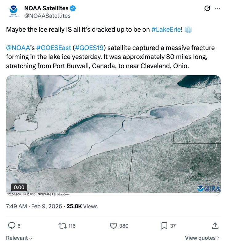
An 80-mile-long crack was captured forming across Lake Erie by a weather satellite, NOAA said on Monday, Feb. 9.
In a post on X on Monday, NOAA shared video from the GOES19 satellite that clearly shows the massive crack spreading across the lake.

“Maybe the ice really IS all it’s cracked up to be on #LakeErie!,” the NOAA Satellites account said on X. “NOAA’s #GOESEast (#GOES19) satellite captured a massive fracture forming in the lake ice yesterday. It was approximately 80 miles long, stretching from Port Burwell, Canada, to near Cleveland, Ohio.”
On Sunday, Feb. 8, ice on the Great Lakes totaled 54.29%, according to the latest charts by the U.S. National Ice Center. Ice cover dipped slightly to 53.01% coverage on Monday, Feb. 9. Lake Superior hit 50% ice coverage, the Ice Center reported.
Lake Erie remains nearly completely frozen over — about 95% coverage. Lake St. Clair Lake, which is included in the Great Lakes ice data, located between the St. Clair River and the Detroit River systems, is completely frozen over, according to the Great Lakes Environmental Research Laboratory, a National Oceanic Atmospheric Administration program.
Lake Huron is nearly three-quarters iced over at 66.64%, down from last week when the total was 77.49%.
The GOES East, GOES-19 satellite monitors weather systems affecting most of North America, including the continental United States and Mexico, as well as Central and South America, the Caribbean, and the Atlantic Ocean to the west coast of Africa.
This article originally appeared on Lansing State Journal: Massive crack forms in Lake Erie ice. See video
Reporting by Dan Basso, Lansing State Journal / Lansing State Journal
USA TODAY Network via Reuters Connect