

By Jim Bloch

If you were asleep at 3:10 a.m. July 16 and did not see the warning from St. Clair County WINS about a severe thunderstorm barreling northeast across southeastern Michigan, maybe the bright flashes of lightning against your shades alerted you to the storm. If you were sleeping with an eye mask, perhaps the bangs of thunder woke you. If you also had your earplugs in, your flooded lawn or flooded street or your flooded basement told the story.
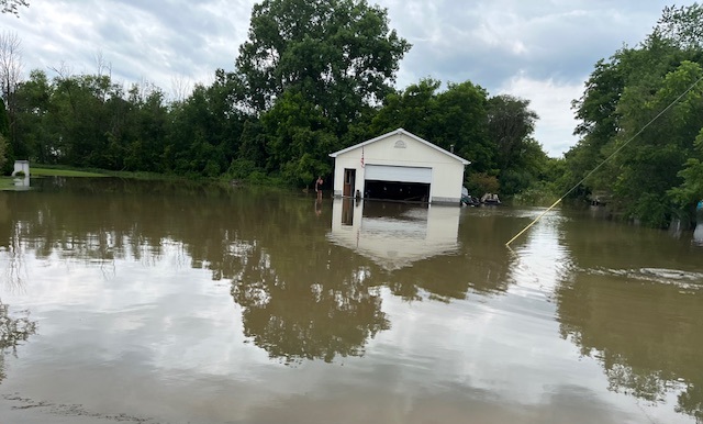
The city of St. Clair and St. Clair Township appeared to be particularly hard hit by the storm. According to iweather.net, the area received as much as 3.2 inches of rain from about 3:45-9 a.m.

Blue River Drive and bordering backyards flooded in the township.
In the city, Brown Street was underwater at the railroad tracks. The water in the outdoor community pool was three inches above the drains that regulate the water level; the water did not dip below the level of drains until 10:30 a.m.
At 11:30 a.m., family members from houses on the west side of Range Road directed traffic through a half-foot of water as the road approached the intersection with Carney Drive. Those houses had water lapping against their foundations and flowing into their garages. The ditches brimmed with water. Homeowners suddenly had ponds in their front yards where none had existed the day before.
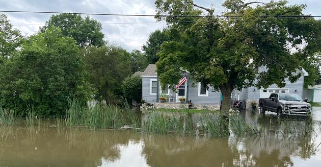
A house on Range Road had a pond for a front yard.
The rain came down in an area already saturated with water. It was the second night and early morning of torrential rains in a row.
The islands on which the gas pumps stand at the Sunoco station north of the Magna plant and Russell Electric on Range became literal islands. Rain inundated the station. Waves rolled over the islands and up to the convenience store.
“The national weather service in Detroit/Pontiac has issued a severe thunderstorm warning for Macomb County (and) St. Clair County in southeastern Michigan until 430 a.m. EDT,” read the WINS alert. “At 3:07 a.m. EDT, severe thunderstorms were located along a line extending from near Birmingham to near Warren to Grosse Pointe, moving northeast at 50 mph.”
The NWS predicted 60 mph wind gusts and told residents to expect damage to roofs, siding and trees.
The storms were expected to roll across Richmond around 3:35 a.m., Capac and Memphis around 3:40 a.m., and St. Clair and Emmett around 3:45 a.m.
“Other locations impacted by these severe thunderstorms include Anchorville, North Street, Roseville, Shelby Township, Ray Center, Brockway, Utica, Washington, Fort Gratiot, and Avoca,” according to the alert. “This includes the following highways…I-94 between mile markers 226 and 273; I-696 between mile markers 21 and 28: I-69 between mile markers 173 and 199; M-39 between mile markers 16 and 24; M-53 between mile markers 16 and 24, and M-59 near mile marker 49.”
The NWS urged motorists to stay away from inundated streets: “Torrential rainfall is occurring with these storms, and may lead to flash flooding. Do not drive your vehicle through flooded roadways.”
Jim Bloch is a freelance writer based in St. Clair, Michigan. Contact him at bloch.jim@gmail.com.
