GRAND RAPIDS — As Greater Lansing braces for another round of severe weather, the National Weather Service has released images tracking the tornadoes that struck Williamston, Leslie and Ionia County on Sunday.
The spin ups in Ingham County damaged homes, barns and outbuildings in the communities with winds that roared up to 110 mph in Williamston and up to 75 mph in the Leslie area, according to NWS meteorologists in Grand Rapids. A man was killed when a tree fell on a home in Stockbridge Township.

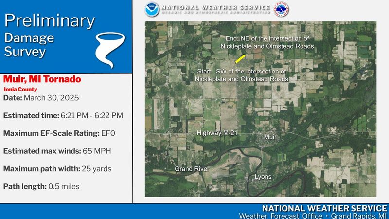
They posted images on X, the social media platform, that showed both twisters arriving and then traveling a northeast path.
Leslie’s EF-0 tornado arrived first, at about 6:20 p.m. and threatened the community for about three minutes. It was about 50-yards wide and traveled a 2.7-mile path that began along Olds Road, east of U.S. 127 to southeast of Kirby Road.
Williamston’s EF-1 tornado was stronger, at about 150 yards wide and blowing through between 6:40 p.m. and 6:45 p.m. It traveled a 5.3-mile path from near Shaftsburg and Sherwood roads to West Lovejoy Road, between South Lovejoy and South Boutell roads.
Two communities in Ionia County also experienced EF-0 tornados on Sunday. Belding’s contained winds of 85 mph. Muir’s had winds of 65 mph.
Sunday’s thunderstorms knocked out power for more than 18,000 in Greater Lansing while a serious ice storm in Northern Michigan has also knocked out power to many people.
Thunderstorms are possible throughout the day on Wednesday, and some could be severe. The highest risk of severe storms will be near and south of Interstate 96, forecasters said.
Contact editor Susan Vela at svela@lsj.com or 248-873-7044. Follow her on Twitter @susanvela.
This article originally appeared on Lansing State Journal: Images show paths of Sunday’s tornadoes in Ingham and Ionia counties
Reporting by Susan Vela, Lansing State Journal / Lansing State Journal
USA TODAY Network via Reuters Connect