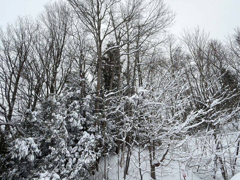
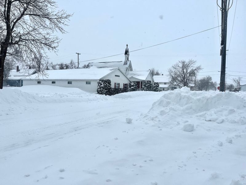
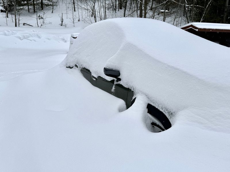
Freshly fallen snow measured in feet shuttered government offices, schools and businesses across the northern Lower Peninsula and Upper Peninsula on Monday, March 16.
The winter storm, which began Sunday with heavy snowfall and gusting winds, will likely put some new records on the books, said Faith Fredrickson, a meteorologist with the National Weather Service (NWS) office in Gaylord.

As of Monday morning, NWS snow observers were reporting 7.5 inches near Sault Ste. Marie, 16.5 inches in Harbor Springs, 23 inches in St. Ignace and 13.3 inches near Traverse City. And more is expected to accumulate throughout the day.
“For now, it looks like another 3 to maybe 6 inches for some of the heavier spots up in the U.P.” said Fredrickson.
Much of the U.P. and northern Lower Peninsula remain in either a Blizzard Warning, Winter Storm Warning or Ice Storm Warning.
Gusting winds are expected to continue as well. On Sunday, blowing snow created visibility issues across the region and led to intermittent closures of the Mackinac Bridge. Flights were also grounded, including at the Cherry Capital Airport in Traverse City.
“We had some very good one-gusts yesterday,” Fredrickson said. “I think some of the strongest were up around 46 mph (around Alpena). We had gusts of 43 at the Gaylord airport as well during the afternoon yesterday.”
In the southern part of the region, unexpected freezing rain has led to power outages for thousands.
“It’s been bad. Really we’ve had a lot of heavy snow that’s fallen in the last basically 24 hours across parts of Leelanau up to the Tip of the Mitt and into the eastern U.P. where a couple of feet has fallen,” Fredrickson said. “Then across areas from Traverse City up into the Gaylord area there’s been quite a bit more sleet mixed in than we had expected. And that kind of southward shift from earlier expectations ended up putting areas down toward Cadillac into Houghton Lake area and up toward Alpena into some additional freezing rain. They had quite a nice storm down there.”
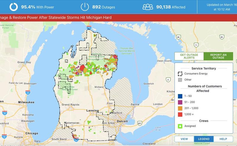
As of 10 a.m. on Monday, Great Lakes Energy was reporting 137 active outages affecting 8,032 customers. Presque Isle Gas & Electric had 118 outages affecting 1,595 customers. Consumers Energy had 874 outages affecting 92,628 residents.
A Great Lakes Energy update said those in Osceola and Kalkaska counties were hardest hit.
“Our teams are prioritizing safety first and foremost as they brave these harsh and unpredictable conditions,” said Great Lakes Energy President and CEO Shaun Lamp in a statement.
Consumers Energy has deployed over 480 crews to work on restoring power.
“This storm has had a tremendous impact on Northern Michigan, particularly from Cadillac to Alpena. We will work closely with community leaders to ensure we’re serving our communities and restoring power as soon as we can do so safely,” said Norm Kapala, one of Consumers Energy’s officers in charge for restoration, in a press release. “No matter how many times the weather tries to test Michigan, we will be ready to respond.”
As roads remain hazardous, many schools, businesses and offices have closed for the day. Gov. Gretchen Whitmer ordered all nonessential state office buildings closed across 15 Upper Peninsula counties and 13 Northern Michigan counties until 6 a.m. on Tuesday, March 17. The State Emergency Operations Center has also been activated.
Area law enforcement continues to encourage residents to stay at home if possible.
In a Monday update, Cheboygan County Emergency Manager Jeremy Runstrom wrote “Emergency crews and road commission teams have been working continuously overnight to clear primary routes. However, many secondary roads remain impassable at this time due to the magnitude of the snowfall.”
While the snow and wind will ease by Tuesday, Fredrickson warned of very cold temperatures on the way.
“It’s going to be windy today. Hunker down if you can and let people get things cleaned up if you can,” she said. “It’s going to be cold tomorrow (Tuesday). We’re expecting highs to be in the teens to maybe 20. The areas that don’t have the power need to be bundled up going into tomorrow. But then it looks like we should warm up going into Wednesday, Thursday and the end of the week.”
Residents are encouraged review weather preparedness tips at ready.gov and follow weather.gov/apx for alerts.
— Contact Jillian Fellows at jfellows@petoskeynews.com.
This article originally appeared on The Petoskey News-Review: Power outages, snowfall grow as storm continues in Northern Michigan
Reporting by Jillian Fellows, The Petoskey News-Review / The Petoskey News-Review
USA TODAY Network via Reuters Connect