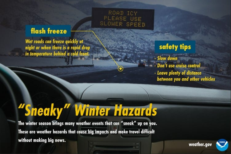
Michigan soon could resemble an ice rink, weather officials say, as temperatures drop rapidly Thursday night and Friday, Dec. 18-19, leading to what’s know as a “flash freeze.”
Rain or snow on the roads, or any surface will freeze quickly as temperatures plummet.

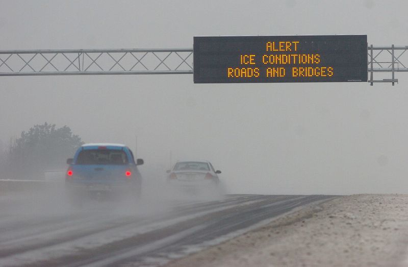
“A flash freeze is possible Thursday night (Dec. 18) as temperatures plummet below freezing. The combination of icy roads, in addition to falling and blowing snow, Thursday night into Friday (Dec. 19) will likely lead to hazardous driving conditions,” the National Weather Service said.
A hazardous weather outlook is in place for a flash freeze possible in the Upper Peninsula and northern Michigan.
“Even when it’s not precipitating, wet roads can quickly turn icy as temperatures dip below freezing. These unexpected slippery conditions can make driving hazardous,” the NWS said. “When roads look wet in the winter, stay cautious, slow down, and don’t use cruise control. Don’t let flash freezes sneak up on you!”
Statewide highs are expected to range in the 30s-40s during the day on Thursday Dec. 18, then they are forecast to drop to the single digits to 20s at night — possibly even below zero. Ironwood in the western Upper Peninsula will get as low as 5 degrees (with a wind chill value of minus 10) Thursday night into Friday morning after a high near 35 on Thursday.
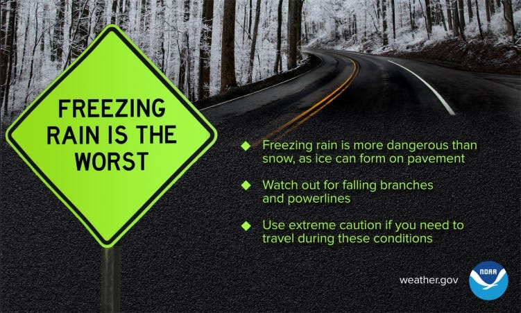
Statewide, rain or snow is in the forecast for Dec. 18-19, with areas seeing a freezing drizzle or freezing rain as temperatures begin to drop.
“Widespread rain will develop ahead of an approaching cold front Thursday (Dec. 18). Widespread rainfall amounts of 0.25 to 0.50 inch are anticipated,” the Detroit NWS said on X on Dec. 17. “Impacts of the rainfall are uncertain, but it’s possible that ponding on area roadways could develop.”
Here’s more on the flash freeze this week in Michigan:
Where is a flash freeze expected in Michigan this week?
A flash freeze is expected, mainly in northern Michigan and the U.P. where temperatures will be colder, but could happen throughout the state. Southeast Michigan, including Detroit, will see temperatures near 50 degrees on Thursday, falling to about 23 overnight into Friday.
According to the NWS’s Probabilistic Precipitation Portal, the eastern U.P. and lower northern areas will see 0.0-0.04 of an inch of ice accumulate by Saturday morning, Dec. 20.
What is a flash freeze?
A flash freeze occurs when there is a sudden drop in temperature from above freezing to well-below freezing, which then allows wet surfaces, like roads or sidewalks, to freeze quickly, according to the NWS.
“When temps rapidly drop below freezing behind a cold front … wet roads can “flash freeze” to ice. Slow down, and don’t use cruise control,” the National Weather Service added in a Facebook post.
What is a freezing drizzle?
According to the NWS glossary, a freezing drizzle is precipitation that freezes into glaze or rime upon contact with the ground or surface structures.
“Ice can form quickly and make roads slick. In these conditions, slow down, don’t use cruise control, and keep plenty of distance between you and other vehicles,” the NWS said.
Contact Sarah Moore @ smoore@lsj.com
This article originally appeared on Lansing State Journal: What’s a flash freeze? Why cold temperatures could create icy hazard
Reporting by Sarah Moore, Lansing State Journal / Lansing State Journal
USA TODAY Network via Reuters Connect