Clear skies aren’t expected to last much longer in Northeast Ohio.

The National Weather Service issued a hazardous weather outlook in the Stark County area for conditions expected June 5 into June 6, as severe weather is possible in the region.
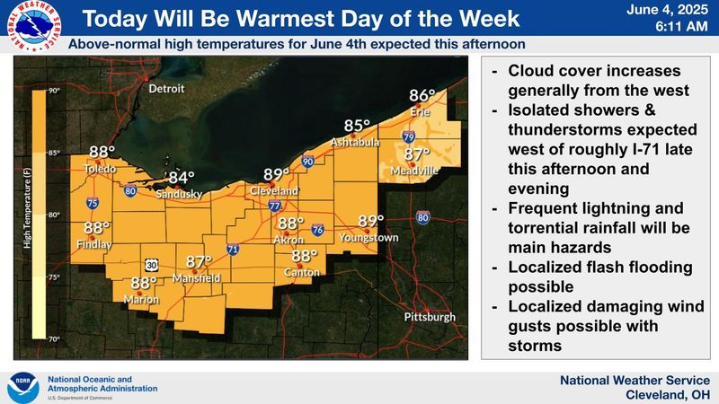
“Scattered to numerous thunderstorms are possible (June 5) into (June 6) as a frontal boundary settles south across the area. Locally heavy rain is possible with thunderstorms and training of storms could lead to the potential for localized flash flooding,” according to the outlook. “The heavier rain becomes focused south of Route 30 on (June 6).”
In the Akron-Canton area, showers and thunderstorms are forecast June 5 before 5 p.m. and remain possible throughout the evening, with new rainfall amounts between a tenth and a quarter of an inch possible.
June 6 will carry a 70% chance of precipitation and possible new rainfall amounts between a quarter and a half of an inch.
What’s the weather forecast for Canton region?
Here’s the seven-day forecast for the Akron-Canton area:
This article originally appeared on The Repository: National Weather Service predicts thunderstorms, flash flooding for Canton region
Reporting by Janson McNair, Canton Repository / The Repository
USA TODAY Network via Reuters Connect