Chilly, fall-like weather has settled over Ohio, and at least two cities have new records as proof of how cold it has been lately.
According to the National Weather Service in Cleveland, Mansfield and Youngstown tied their record low temperatures for Sunday, Sept. 7.

But for those still hoping for a bit of summer, is the forecast warming up? This is Ohio, after all, so hot days and cold nights aren’t out of the question. Plus, the fall equinox, the official start of fall, isn’t until Sept. 22, and daylight saving time doesn’t end until early November, so it’s possible summer-like weather will reassert itself.
Here’s a look at the forecast and the latest weather records.
Youngstown, Mansfield tie record low temperatures on Sunday, Sept. 7, 2025
On Facebook, the NWS office in Cleveland announced that Mansfield had a record low of 42 degrees on Sunday, Sept. 7. That tied the record low temperature that was also reached in 1956, 1962 and 1988. The average low temperature for Sept. 7 in the Mansfield area is 56.7 degrees, according to NWS weather data.
Likewise, a record low of 39 degrees was set at the Youngstown Airport on Sunday, Sept. 7, tying the previous record set in 1986. The average low for that date is 54.8 degrees, per NWS data.
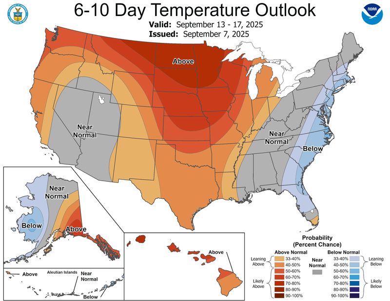
Weather forecast for Akron, Columbus and Cincinnati
The 6-10 day temperature outlook from the NWS sees normal to slightly above normal temperatures around Ohio from Sept. 13 to 17. That means highs in the mid to high 70s and lows in the mid 50s, according to NWS data.
This week’s forecast for Akron, Columbus and Cincinnati sees a warmup coming, with highs climbing into the mid to high 80s by the weekend. Here’s a look:
This article originally appeared on Akron Beacon Journal: Mansfield, Youngstown tie record lows. Is a warmup coming? See the Ohio weather forecast
Reporting by Chad Murphy, Akron Beacon Journal / Akron Beacon Journal
USA TODAY Network via Reuters Connect