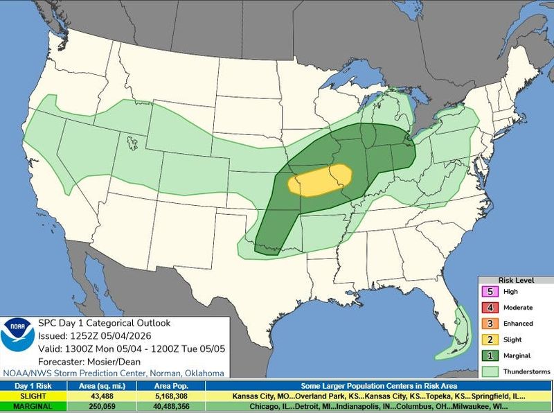
Thunderstorms are forecast to develop ahead of a cold front in Michigan’s Lower Peninsula Monday night, May 4, into Tuesday morning, May 5. Strong wind gusts, hail and lightning are possible threats.
“There is a marginal risk of strong to severe storms from Metro Detroit south today and tonight (May 1),” the National Weather Service in White Lake said on X on May 1. “Primary window for potential severe storms is between 6 PM and midnight. An isolated storm could produce damaging wind gusts up to 60 mph and large hail up to 1 inch.”

The southern half of the Lower Peninsula has the highest risk to see severe conditions.
In Lansing, rain is forecast to develop as early as 9 p.m. on Monday, May 4. Thunder is possible from 11 p.m. to 1 a.m. and rain will persist into Tuesday, May 5.
By Tuesday afternoon, May 5, up to 0.5 of an inch of rain is expected to accumulate with the heaviest in cities near the Ohio border, according to the Probabilistic Precipitation Portal.
“Monday is the one milder day expected for the coming week, though clouds and rain chances will be increasing during the day (May 4). We’ll be back to cooler than normal weather for midweek,” the Gaylord NWS office said on X on May 3.
Monday, May 4, is expected to be the warmest day of the work week.
From Tuesday, May 5, through Thursday, May 7, highs are forecast in the 50s-60s in the southern Lower Peninsula, while the northern Lower Peninsula and the Upper Peninsula are forecast cooler highs in the 40s-50s.
As storms brew, residents are urged to have multiple ways to receive weather alerts during the day and night.
Here’s the live radar and current warnings, watches and advisories in Michigan.
Michigan Doppler radar
Michigan weather watches and warnings
Contact Sarah Moore @ smoore@lsj.com
This article originally appeared on Lansing State Journal: Thunderstorms possible in Michigan on Monday. See 24-hour forecast
Reporting by Sarah Moore, USA TODAY NETWORK / Lansing State Journal
USA TODAY Network via Reuters Connect