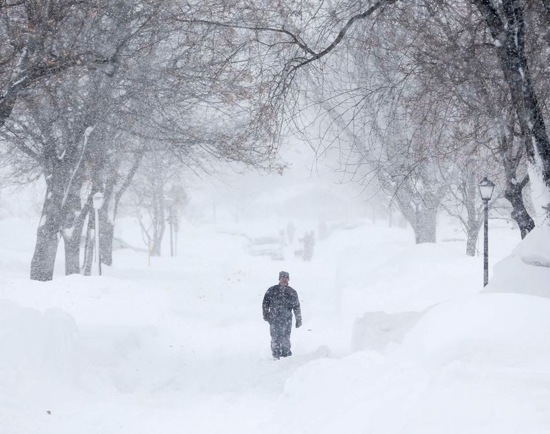
Snow is expected is expected statewide this weekend across much of Michigan, including Detroit, Grand Rapids, northern Michigan and the Upper Peninsula — much of it blamed on lake effect.
“Our first real taste of winter arrives this weekend, with snowy weather Saturday night (Nov. 8) and beyond,” the NWS in Gaylord said on X on Nov. 5.

Additionally, in Marquette, the NWS forecasts possible weak lake-effect rain and snow in the eastern Upper Peninsula this weekend.
“The coldest airmass of the season is expected to impact Upper Michigan this weekend. High temperatures will only top off in the 30s with lows in the teens and twenties. In addition, the NNW wind snowbelts could see some accumulating lake effect snow,” the NWS in Marquette said on X.
Areas along Lake Michigan also could see snow accumulations.
“Accumulating snow is possible in portions of Lower Michigan late this weekend into early next week. For now, the chance of Sat night to Sunday being no big deal for your town is higher than the chance of a huge snowstorm,” the NWS in Grand Rapids said on X.
The National Weather Service said how much ends up on the ground depends on how cold it gets, and how warm the ground remains as it snows.
Snow along Lake Michigan and Lake Superior shorelines is driven by what’s known as lake effect, a phenomenon in which moisture-laden air drops heavy snow in some places downwind from large bodies of water while other areas receive almost nothing.
Here’s everything to know about lake effect snow this winter season:
What is lake effect snow
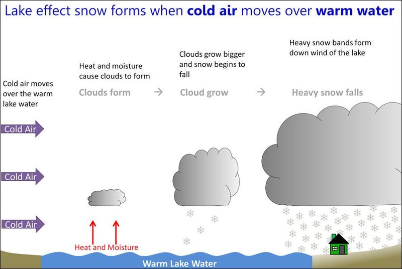
Lake effect snow occurs when cold air moves across the open waters of the Great Lakes creating snowfall, said Lily Chapman, a meteorologist at the NWS Forecast office in Marquette.
During the fall and winter months, colder air moves across the warmer Great Lakes. Water evaporates from the lakes, adding moisture to the lowest portion of the atmosphere, according to the National Weather Service.
The air rises and clouds grow. Once the air moves onto shore, the moisture begins to condense and fall as snow — producing as much as 2-3 inches of snow per hour.
If the weather is cold enough and the lakes freeze over, less snow falls because the water can’t evaporate into the air.
Where does lake effect snow tend to fall?
Physical geography of the land, water and wind direction are all components that factor into where the snow will fall.
In Michigan, lake effect snow most often tends to fall in western Upper Peninsula, along the north shore of the UP, and in the Lower Peninsula from the tip of the mitten to Indiana along Lake Michigan.
If winds come from the east, Lake Huron can provide the moisture and the eastern portions of Michigan area affected, rather than the west side.
According to the University of Michigan, the Upper Peninsula of Michigan is one of the largest and most distinct snow belts in the United States with the west side of the state not far behind.
Jalen Williams is a trending reporter at the Detroit Free Press. Contact him at jawilliams1@freepress.com.
This article originally appeared on Detroit Free Press: Lake-effect snow’s in the forecast. Here’s what to know
Reporting by Jalen Williams, Detroit Free Press / Detroit Free Press
USA TODAY Network via Reuters Connect