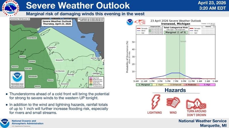
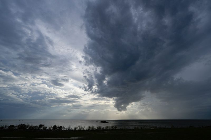
Michigan is expected to see rain, with potentially strong thunderstorms, statewide on Thursday night, April 23.
“Thunderstorms ahead of a cold front will bring the potential for strong to severe winds to the western UP tonight (April 23). In addition to the wind and lightning hazards, rainfall totals of up to 1 inch will further increase flooding risk, especially for rivers and streams,” the Marquette National Weather Service on X on April 23.

By Friday morning, April 24, some areas could get up to an inch of rain, with the heaviest falling in the western side of the Upper Peninsula, according to the Probabilistic Precipitation Portal.
Thunderstorms could continue into Friday, the National Weather Service said as a cold front pushes eastward.
“A Marginal Risk for Severe Thunderstorms exists along the Ohio border and possibly west of U.S. 23 Friday afternoon and evening. Potential exists for isolated strong to severe storms capable of producing wind gusts to 60 mph and large hail,” the Detroit NWS said on X on April 23.
Quarter-sized hail, 60 mph winds, flooding and lightning are the main threats with Thursday’s and Friday’s storms.
A flood watch is in place for Baraga, Dickinson, Iron, Marquette, Houghton, Ontonagon, Keweenaw counties in the western U.P. Flood warnings are also in place for high water on several rivers across Michigan.
Weather officials urge residents to have multiple ways of receiving weather updates throughout the day and night.
Here’s the Michigan radar and where flood warnings are in place as of April 23:
Rain is on the move: See Michigan Doppler weather radar
Current weather warnings, advisories for Michigan
Contact Sarah Moore @ smoore@lsj.com
This article originally appeared on Lansing State Journal: Thunderstorms forecast for Michigan. When to expect bad weather
Reporting by Sarah Moore, Lansing State Journal / Lansing State Journal
USA TODAY Network via Reuters Connect