A seemingly familiar weather setup could unfold over Texas this weekend, echoing one seen earlier this summer — but forecasters stress the similarities are broad, not exact.
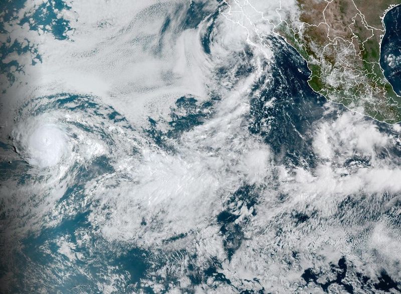
Moisture from Hurricane Lorena, which is weakening Sept. 5 off the Pacific coast, will drift northeast into Texas over the weekend. That tropical moisture will interact with a cold front sagging into far West Texas, raising the risk of heavy rainfall.

The setup loosely resembles the conditions that produced catastrophic, 1,000-year flooding in the Hill Country over the Fourth of July, which killed more than 100 people, including dozens from the all-girls Camp Mystic along the Guadalupe River.
At the time, moisture from an eastern Pacific hurricane moved over Texas and interacted with the remnants of Tropical Storm Barry, which had made landfall on the Yucatán Peninsula before drifting inland.
But meteorologists emphasize that’s where the comparison ends.
How this weather setup is different
While the setup bears a superficial resemblance to July’s disaster, the differences are significant, experts say.
Lorena is weakening quickly and moving faster than July’s systems, a meteorologist with the National Weather Service office in Austin-San Antonio said. Its remnant energy and moisture are expected to stream northeast and collide with the cold front, potentially bringing 1 to 5 inches of rain to parts of the state.
Moisture from the eastern Pacific will combine with return flow from the Gulf and a weak northern boundary, which can spark scattered storms. While this also involves two sources of moisture converging, the setup is transient and less organized than July’s, limiting the potential for extreme rainfall.
Unlike the Fourth of July floods, there is also no stalled mid-level system to trap moisture and produce “training” thunderstorms. During July, a mesoscale convective vortex (MCV) acted like a small, semi-stationary low-pressure system, keeping storms anchored and enhancing lift over the same areas for hours.
This weekend, forecasters expect passing showers and storms rather than prolonged, catastrophic rainfall, with totals generally in the 1- to 5-inch range Sunday into Monday, Sept. 7–8.
What to expect this weekend in Texas
According to the National Weather Service in Austin-San Antonio, a cold front will slide into the state by Saturday, Sept. 6, bringing scattered storms. The main focus will be Sunday into Monday, Sept. 7–8, when remnants of Lorena meet the front and push deep tropical moisture into the Hill Country and Edwards Plateau.
That overlap could produce heavy downpours, but models show lower rainfall totals than the July floods, and the Weather Prediction Center has placed the region under only a marginal risk for flash flooding.
“Storm chances are slightly more favored over the Coastal Plains and over the southern Edwards Plateau where instability is slightly higher, though low to medium rain chances are seen for the entirety of South Central Texas,” the National Weather Service wrote in its area forecast discussion on Sept. 5.
Will river levels contribute to flooding?
River conditions also differ from July.
Hill Country rivers, including the Guadalupe, are running lower after weeks of receding, which reduces — though doesn’t eliminate — the chance of widespread flooding.
Leading up to the July floods, several rounds of storms from May through late June had already saturated the soil and kept river levels high, priming the region for disaster.
While current river levels are lower and the ground is less saturated, localized flash flooding remains possible in flood-prone areas and along smaller creeks.
Local forecasters with the National Weather Service office in Austin-San Antonio stressed they weren’t “downplaying” the potential hazards but reiterated that the scale of flooding will not mirror July’s disaster.
Texas weather watches and warnings
Stay informed. Get weather alerts via text
Brandi D. Addison covers weather across the United States as the Weather Connect Reporter for the USA TODAY Network. She can be reached at baddison@gannett.com.
This article originally appeared on Corpus Christi Caller Times: Tropical moisture lingers over Texas, but conditions differ from July floods. What to expect
Reporting by Brandi D. Addison, USA TODAY NETWORK / Corpus Christi Caller Times
USA TODAY Network via Reuters Connect