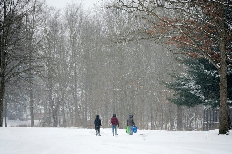
Winter is still hanging around Greater Akron.
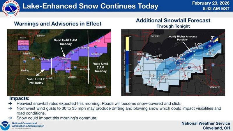
A Winter Weather Advisory remains in effect for Summit and Medina counties until 1 a.m. Tuesday.

The National Weather Service says Lake Erie enhanced snow is expected to continue Monday in Greater Akron.
Anywhere from 2 to 4 inches of additional snow is possible where heavy squalls persist.
By the time everything is said and done, the weather service says some communities could see a half a foot of snow or more.
Snow emergencies were issued in Summit and Medina counties where some schools were closed for the day on Monday.
It will be blustery on Monday with wind gusts of up to 35 miles per hour possible.
“Plan on slippery road conditions with slower travel likely,” the weather service says. “The hazardous conditions could impact the morning and evening commutes.”
Flights at the Akron-Canton Airport have not been impacted by the snowy weather. There were a couple of delays for Chicago-bound flights.
A large number of flights at Cleveland Hopkins International Airport were cancelled Monday as a result of the snow storm impacting the East Coast, particularly New Jersey and New York.
More winter storms could impact Greater Akron
The weather service says another potential winter storm is brewing later this week.
A clipper system is expected Tuesday night into Wednesday morning with some accumulating snow possible.
A second storm system on Thursday could bring another round of widespread accumulating snow to Northeast Ohio depending on its track.
Akron weather radar
Akron weather forecast
Monday: Snow showers. Patchy blowing snow between noon and 2 p.m. High near 30. Northwest wind 15 to 17 mph, with gusts as high as 29 mph. Chance of precipitation is 80%. Total daytime snow accumulation of around an inch possible.
Monday night: A chance of snow showers, mainly before 10 p.m. Mostly cloudy, with a low around 16. Northwest wind 5 to 11 mph, with gusts as high as 24 mph. Chance of precipitation is 30%. New snow accumulation of less than a half inch possible.
Tuesday: Partly sunny, with a high near 35. Light and variable wind becoming south 6 to 11 mph in the morning. Winds could gust as high as 22 mph.
Tuesday night: Snow. Low around 29. South wind 11 to 14 mph, with gusts as high as 29 mph. Chance of precipitation is 80%. New snow accumulation of around an inch possible.
Wednesday: A slight chance of snow before 1 p.m. Mostly cloudy, with a high near 39. West wind 11 to 14 mph, with gusts as high as 28 mph. Chance of precipitation is 20%.
Wednesday night: A slight chance of snow after 1 a.m. Mostly cloudy, with a low around 20. Chance of precipitation is 20%.
Thursday: A chance of snow. Mostly cloudy, with a high near 38. Chance of precipitation is 50%.
Thursday night: Partly cloudy, with a low around 18.
Friday: Mostly sunny, with a high near 42.
Friday night: Mostly clear, with a low around 31.
Saturday: Sunny, with a high near 49.
Saturday night: Mostly cloudy, with a low around 27.
Sunday: Mostly cloudy, with a high near 38.
Akron weather hourly
Need to know weather conditions by the hour? Make sure to check out our weather page here.
This article originally appeared on Akron Beacon Journal: Winter weather advisory extended for Akron-area, more snow storms likely
Reporting by Craig Webb, Akron Beacon Journal / Akron Beacon Journal
USA TODAY Network via Reuters Connect