New York could see a return of Arctic air around Thanksgiving as models suggest a possible wobble in the polar vortex, which could push frigid air into the northern U.S.
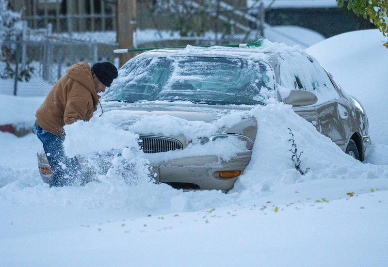
It’s unclear whether this event will be as intense as this week’s system — which brought up to a foot of snow near Buffalo — though the cold is unlikely to reach as far south as it did when record-breaking temperatures hit parts of Florida.

Forecasts from the Climate Prediction Center, which had previously projected above-normal temperatures for much of the U.S. this winter, similarly now show below-average temperatures for roughly half the country through the end of November. Meanwhile, the Southeast and southern Great Plains are expected to remain warmer than normal.
According to the Climate Prediction Center, the Madden-Julian Oscillation (MJO) — a moving pattern of thunderstorms in the tropics — can influence how cold or warm air shifts across the U.S., while La Niña — a cooling of the tropical Pacific Ocean — tends to push Arctic air farther south, increasing the chance of cold outbreaks across the northern states.
Combined, these patterns are likely to mean an “increased cold air intrusion across the northern tier of the contiguous United States” around Thanksgiving, the forecast states.
For New York, that means the potential for more lake-effect snow.
What is the polar vortex?
The polar vortex is a swirling mass of frigid air high in the atmosphere that normally circles the Arctic, according to the National Weather Service. Sitting in the stratosphere, it usually keeps the coldest air locked near the North Pole.
Contrary to what its description may suggest, a weakened polar vortex can bring harsher winter weather to the U.S., while a strong vortex keeps Arctic air contained, leading to milder winter conditions here.
What does the polar vortex look like right now?
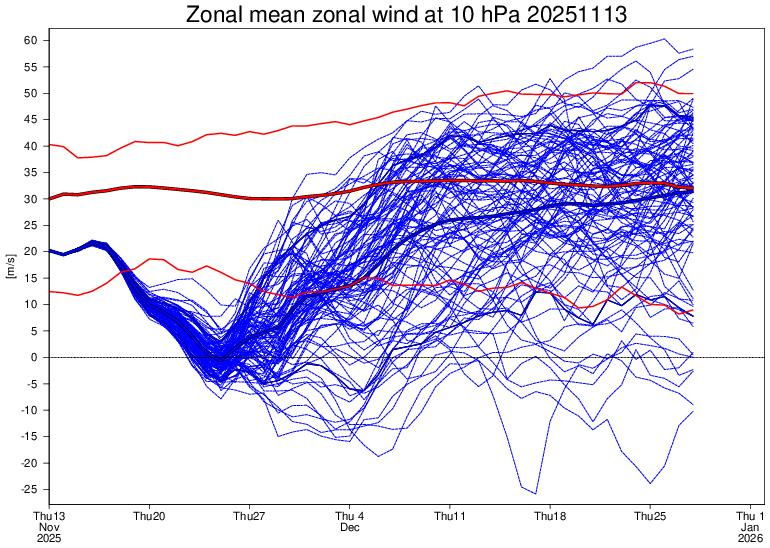
Right now, charts show the polar vortex is unusually weak — similar to its strength in early autumn — and could wobble south, sending Arctic air into the U.S. around Thanksgiving.
This weakness is linked to very low winds high above the Arctic, called zonal winds, which are now declining and approaching 0 m/s, a threshold that can trigger an event called major sudden stratospheric warming (SSW). These events often lead to significant cold outbreaks and even blizzards.
(Note about graph: The dashed 0 m/s line marks the boundary between westerly winds (above the line), which represent a normal, intact stratospheric polar vortex, and easterly winds (below the line), which indicate a reversal of the vortex and meet the definition of a major sudden stratospheric warming if sustained. In the graph, many forecast members (blue lines) dip toward or below 0 m/s in late November, showing the potential for a significant weakening or even reversal of the 10 hPa zonal winds, compared with the typical climatological values shown in red.)
The vortex’s instability is also influenced by the Quasi-Biennial Oscillation (QBO), a stratospheric wind pattern that shifts between easterly and westerly roughly every 28–29 months. When the QBO is in its easterly phase, as it is now, the vortex is more prone to wobble south.
Meanwhile, a weak La Niña in the lower atmosphere is shaping winter patterns as well. While it doesn’t directly affect the polar vortex, it can shift the jet stream, influencing where Arctic air travels and how long cold outbreaks linger. La Niña may also leave parts of the Great Lakes unfrozen, increasing the risk of lake-effect snow when Arctic air moves over open water.
How soon could Arctic air hit?
While not all models agree, a noticeable chill is expected, even if it doesn’t amount to a full Arctic blast. The zonal winds are expected to begin slowing as early as next week.
Because it takes several days for changes in the stratosphere to impact surface weather, Arctic air could begin spilling south around Thanksgiving, Nov. 27, bringing the first taste of cold and potentially triggering early lake-effect snow over the still-warm Great Lakes.
The coldest conditions are likely to arrive a few days later, in early December — about 10 days after the stratospheric warming peaks.
New York weather forecast for Thanksgiving
The Climate Prediction Center says Nov. 22–Dec. 5 could bring big swings in U.S. weather, with periods of warmth followed by cold.
Early in the period, the western U.S. is expected to be cooler than normal, while the East may stay relatively mild. By the second week, however, Arctic air could push across the northern U.S., including New York, raising the chances of below-average temperatures for the northern states, the Midwest, and parts of the Mid-Atlantic and New England.
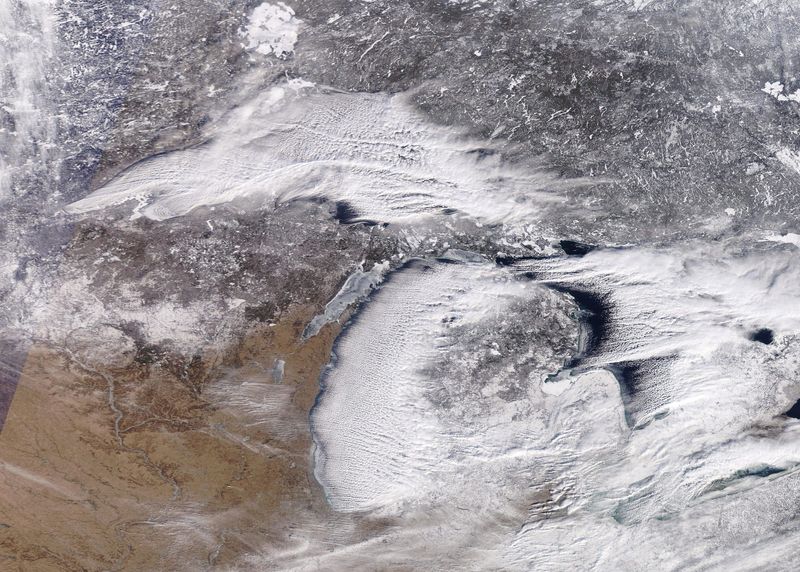
As the cold air moves in, the Great Lakes region may see lake-effect snow, which happens when cold winds pass over the still-open, warmer waters of the lakes.
“Slightly enhanced chances for above-median precipitation across the Great Lakes region is partly tied to possible lake effect snow events,” the Climate Prediction Center wrote on Nov. 7 about the last week of November.
What is lake-effect snow?
Lake-effect snow typically happens when cold, dry Arctic air moves over a large, relatively warm lake, creating narrow bands of clouds that can dump snow anywhere from a few minutes to several days.
Wind direction also matters a lot — it can mean heavy snow in one town while a sunny mile or two away sees nothing:
What is La Niña?
La Niña — Spanish for “the girl” — happens when the surface waters of the central and eastern Pacific Ocean are colder than normal for several months in a row, according to the National Weather Service. It’s part of a natural climate pattern called the El Niño–Southern Oscillation, which flips back and forth every few years between La Niña (cooler waters) and El Niño (warmer waters).
These shifts in ocean temperatures may seem small, but they can nudge the jet stream and change weather patterns all over the world. While its counter part El Niño — “the boy” — often brings milder winters to the northern U.S., La Niña tends to set the stage for colder snaps and more volatile conditions there.
When ocean temperatures in the central and eastern Pacific are close to average — not unusually warm like El Niño or unusually cool like La Niña — scientists call it ENSO neutral. Neutral conditions mean the Pacific isn’t giving the atmosphere a strong push one way or the other, so seasonal weather patterns are more likely to be shaped by other factors, like the Arctic or Atlantic oceans.
New York weather watches and warnings
Stay informed. Get weather alerts via text
Brandi D. Addison covers weather across the United States as the Weather Connect Reporter for the USA TODAY Network. She can be reached at baddison@gannett.com. Find her on Facebook here.
This article originally appeared on Rochester Democrat and Chronicle: Is the polar vortex wobbling? Arctic air could slam New York near Thanksgiving
Reporting by Brandi D. Addison, USA TODAY NETWORK / Rochester Democrat and Chronicle
USA TODAY Network via Reuters Connect