Arctic air will settle over Michigan this week, bringing several days of sub-freezing temperatures and a renewed threat of lake-effect snow as the workweek unfolds.
Cold air will surge into the Great Lakes behind a series of fast-moving systems, keeping daytime highs below freezing for much of the state and setting the stage for accumulating snow — especially in lake-effect-prone areas — through at least midweek.

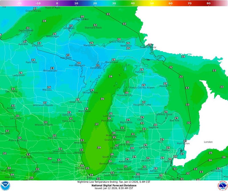
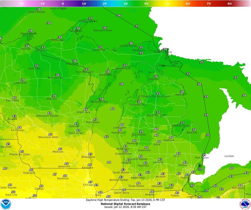
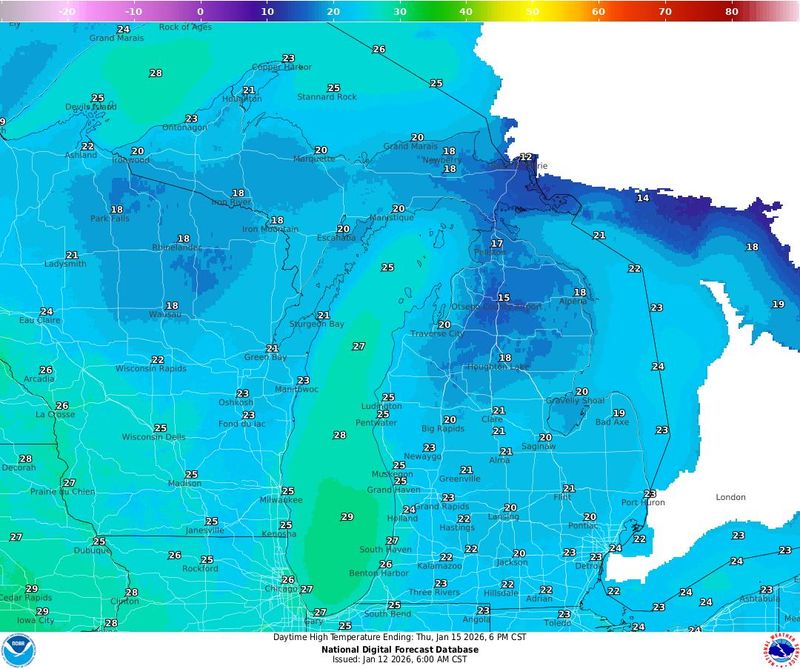
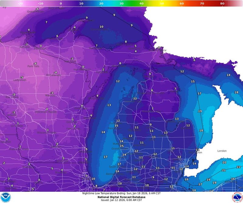
While the week will begin with temperature highs reaching the upper-30s to mid-40s, beginning late Tuesday, temperatures will set to stay persistently frigid, struggling to climb above freezing through the weekend.
“Rapid warm-up forecast across much of the Lower 48 today and tomorrow,” the Climate Prediction Center forecast states. “The lone exception to this warm stretch will fall along the Gulf Coast, which could experience marginally freezing overnight temperatures beneath the high pressure center. Cold air should eventually return east of the Continental Divide beyond Tuesday behind a series of cold fronts. A deepening low pressure center along these fronts also will support additional wintry weather over the Upper Midwest and Northeast.”
How long will the cold last in Michigan?
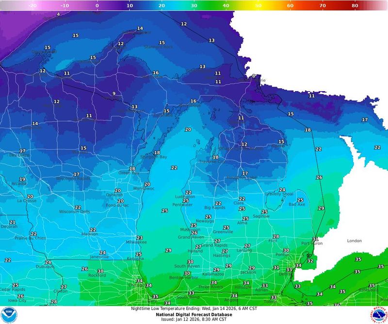
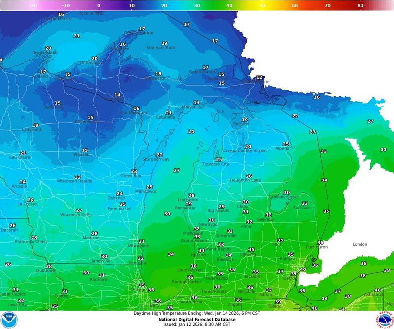
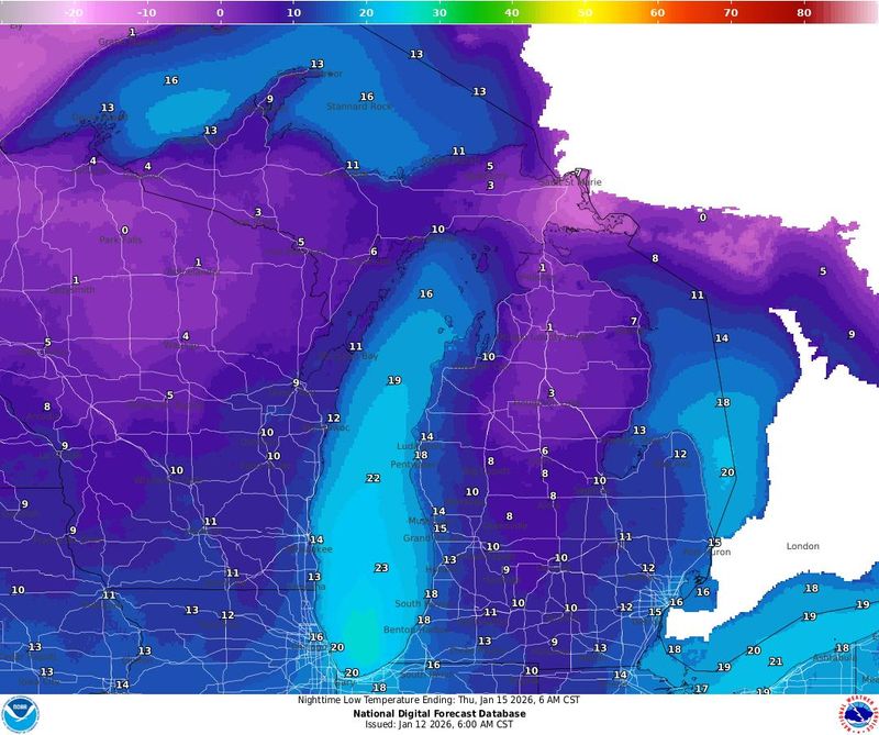
Forecasters say the cold pattern is expected to persist for several days, with the chilliest air arriving Tuesday night into Wednesday, Jan. 13-14, as Arctic air pours south across the Great Lakes, according to the National Weather Service in Marquette.
Highs across much of Michigan’s Lower Peninsula are expected to remain in the 20s to low 30s through midweek, with overnight lows dipping into the teens. Colder conditions are likely in northern Michigan and the Upper Peninsula, where temperatures will fall more sharply behind a strong cold front.
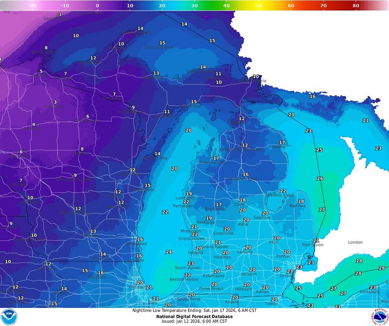
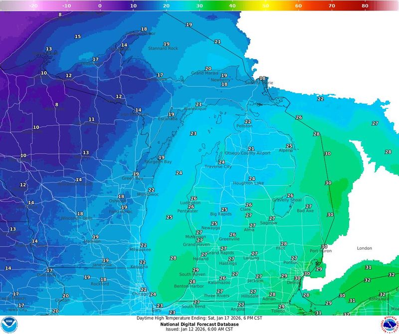
While a brief lull is possible later Thursday, additional clipper systems later this week could reinforce the colder-than-normal pattern and bring more chances for snow.
Lake-effect snow ramps up midweek
Snow chances will increase significantly Tuesday night and Wednesday, Jan. 13-14, as colder air crosses the relatively warm waters of Lake Superior and Lake Michigan.
In the Upper Peninsula, snow is expected to intensify late Tuesday night into Wednesday morning, Jan. 13-14, as colder air deepens and winds turn northerly. Forecasters expect snowfall rates of up to 1 inch per hour in favored snowbelts, particularly along Lake Superior.
“A secondary cold front will reinvigorate heavy lake effect snow and northerly wind gusts upwards of 40-50 mph early Wednesday morning,” the National Weather Service wrote. “Blowing snow creating areas of very low visibility will create hazardous travel conditions before and during the Wednesday morning commute.”
Snowfall totals of more than 6 inches are possible in portions of the Keweenaw Peninsula and higher terrain of the western Upper Peninsula through early Wednesday, according to Weather Prediction Center probabilities.
Lower Peninsula impacts possible
As the cold air pushes south, lake-effect snow bands may develop off Lake Michigan late Wednesday into Wednesday night.
Forecast guidance suggests a potent lake-effect setup could produce a narrow band of heavy snow somewhere along the Lake Michigan shoreline, with the exact placement still uncertain. Areas from southwest Michigan into northwest Indiana could see accumulating snow if the band sets up over land for an extended period.
Elsewhere in the Lower Peninsula, multi-band lake-effect snow showers could bring periods of reduced visibility and light to moderate accumulations, particularly west of U.S. 131.
Maps show how cold temperatures will get in Michigan
Michigan weather watches and warnings
Michigan Upper Peninsula Doppler radar
Stay informed. Get weather alerts via text
Brandi D. Addison covers weather across the United States as the Weather Connect Reporter for the USA TODAY Network. She can be reached at baddison@gannett.com. Find her on Facebook here.
This article originally appeared on Detroit Free Press: How long will the cold last? Arctic air to settle over Michigan
Reporting by Brandi D. Addison, USA TODAY NETWORK / Detroit Free Press
USA TODAY Network via Reuters Connect